Liausson
| Liausson | |
|---|---|
|
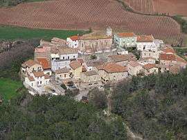
A general view of Liausson | |
 Liausson | |
|
Location within Occitanie region  Liausson | |
| Coordinates: 43°38′12″N 3°22′14″E / 43.6367°N 3.3706°ECoordinates: 43°38′12″N 3°22′14″E / 43.6367°N 3.3706°E | |
| Country | France |
| Region | Occitanie |
| Department | Hérault |
| Arrondissement | Lodève |
| Canton | Clermont-l'Hérault |
| Intercommunality | Clermontais |
| Government | |
| • Mayor (2008–2014) | Alain Soulayrol |
| Area1 | 7.95 km2 (3.07 sq mi) |
| Population (2008)2 | 126 |
| • Density | 16/km2 (41/sq mi) |
| Time zone | CET (UTC+1) |
| • Summer (DST) | CEST (UTC+2) |
| INSEE/Postal code | 34137 / 34800 |
| Elevation |
135–537 m (443–1,762 ft) (avg. 210 m or 690 ft) |
|
1 French Land Register data, which excludes lakes, ponds, glaciers > 1 km² (0.386 sq mi or 247 acres) and river estuaries. 2 Population without double counting: residents of multiple communes (e.g., students and military personnel) only counted once. | |
Liausson is a commune in the Hérault département in the Occitanie region in southern France.
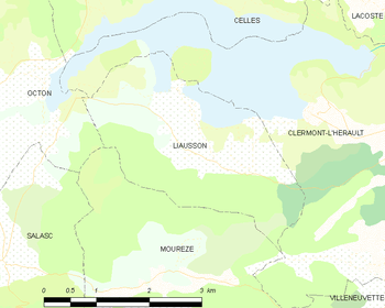
Map
Population
| Historical population | ||
|---|---|---|
| Year | Pop. | ±% |
| 1962 | 66 | — |
| 1968 | 89 | +34.8% |
| 1975 | 84 | −5.6% |
| 1982 | 99 | +17.9% |
| 1990 | 95 | −4.0% |
| 1999 | 110 | +15.8% |
| 2008 | 126 | +14.5% |
Sights
The church was built on the ruined foundations of a Roman villa
Gallery
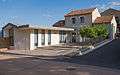 La mairie.
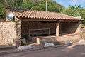 Le lavoir.
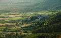 Dawn on the village.
 "Montagne de Liausson" from Villeneuvette.
See also
References
| Wikimedia Commons has media related to Liausson. |
This article is issued from Wikipedia - version of the 11/12/2016. The text is available under the Creative Commons Attribution/Share Alike but additional terms may apply for the media files.