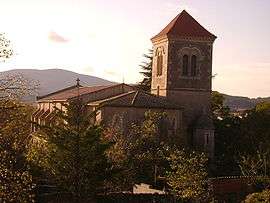
Ferrals-les-Corbières
| Ferrals-les-Corbières | ||
|---|---|---|
 | ||
| ||
 Ferrals-les-Corbières | ||
|
Location within Occitanie region  Ferrals-les-Corbières | ||
| Coordinates: 43°08′52″N 2°43′41″E / 43.1478°N 2.7281°ECoordinates: 43°08′52″N 2°43′41″E / 43.1478°N 2.7281°E | ||
| Country | France | |
| Region | Occitanie | |
| Department | Aude | |
| Arrondissement | Narbonne | |
| Canton | Lézignan-Corbières | |
| Intercommunality | Région Lézignanaise | |
| Government | ||
| • Mayor (2008–2014) | Gérard Barthez | |
| Area1 | 15.95 km2 (6.16 sq mi) | |
| Population (2008)2 | 1,076 | |
| • Density | 67/km2 (170/sq mi) | |
| Time zone | CET (UTC+1) | |
| • Summer (DST) | CEST (UTC+2) | |
| INSEE/Postal code | 11140 / 11200 | |
| Elevation |
47–248 m (154–814 ft) (avg. 61 m or 200 ft) | |
|
1 French Land Register data, which excludes lakes, ponds, glaciers > 1 km² (0.386 sq mi or 247 acres) and river estuaries. 2 Population without double counting: residents of multiple communes (e.g., students and military personnel) only counted once. | ||
.svg.png)
Ferrals-les-Corbières is a commune in the Aude department in southern France.
Geography
The river Orbieu flows northeast through the western part of the commune and crosses the village.
Population
| Historical population | ||
|---|---|---|
| Year | Pop. | ±% |
| 1962 | 1,053 | — |
| 1968 | 1,080 | +2.6% |
| 1975 | 1,057 | −2.1% |
| 1982 | 972 | −8.0% |
| 1990 | 1,019 | +4.8% |
| 1999 | 1,004 | −1.5% |
| 2008 | 1,076 | +7.2% |
See also
References
| Wikimedia Commons has media related to Ferrals-les-Corbières. |
This article is issued from Wikipedia - version of the 3/18/2013. The text is available under the Creative Commons Attribution/Share Alike but additional terms may apply for the media files.