Pinon, Aisne
| Pinon | |
|---|---|
|
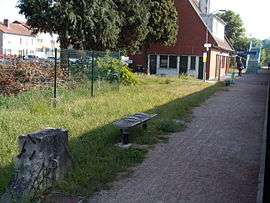
Train station | |
 Pinon | |
|
Location within Hauts-de-France region  Pinon | |
| Coordinates: 49°29′18″N 3°26′47″E / 49.4883°N 3.4464°ECoordinates: 49°29′18″N 3°26′47″E / 49.4883°N 3.4464°E | |
| Country | France |
| Region | Hauts-de-France |
| Department | Aisne |
| Arrondissement | Laon |
| Canton | Anizy-le-Château |
| Intercommunality | Vallons d'Anizy |
| Government | |
| • Mayor (2008–2014) | Patrick Vitu |
| Area1 | 9.48 km2 (3.66 sq mi) |
| Population (2012)2 | 1,811 |
| • Density | 190/km2 (490/sq mi) |
| Time zone | CET (UTC+1) |
| • Summer (DST) | CEST (UTC+2) |
| INSEE/Postal code | 02602 / 02320 |
| Elevation |
54–158 m (177–518 ft) (avg. 78 m or 256 ft) |
|
1 French Land Register data, which excludes lakes, ponds, glaciers > 1 km² (0.386 sq mi or 247 acres) and river estuaries. 2 Population without double counting: residents of multiple communes (e.g., students and military personnel) only counted once. | |
Pinon is a commune in the Aisne department in Hauts-de-France in northern France.
Geography
The river Ailette forms all of the commune's northern border.
Population
| Historical population | ||
|---|---|---|
| Year | Pop. | ±% |
| 1962 | 1,636 | — |
| 1968 | 1,807 | +10.5% |
| 1975 | 1,916 | +6.0% |
| 1982 | 1,941 | +1.3% |
| 1990 | 1,773 | −8.7% |
| 1999 | 1,711 | −3.5% |
| 2008 | 1,755 | +2.6% |
| 2012 | 1,811 | +3.2% |
See also
References
| Wikimedia Commons has media related to Pinon, Aisne. |
This article is issued from Wikipedia - version of the 11/8/2016. The text is available under the Creative Commons Attribution/Share Alike but additional terms may apply for the media files.