Périers-en-Auge
| Périers-en-Auge | |
|---|---|
|
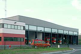
Fire station | |
 Périers-en-Auge | |
|
Location within Normandy region  Périers-en-Auge | |
| Coordinates: 49°15′26″N 0°04′42″W / 49.2572°N 0.0783°WCoordinates: 49°15′26″N 0°04′42″W / 49.2572°N 0.0783°W | |
| Country | France |
| Region | Normandy |
| Department | Calvados |
| Arrondissement | Lisieux |
| Canton | Dozulé |
| Intercommunality | Pays d'Auge dozuléen |
| Government | |
| • Mayor (2008–2014) | Alain Fontaine |
| Area1 | 5.09 km2 (1.97 sq mi) |
| Population (2008)2 | 140 |
| • Density | 28/km2 (71/sq mi) |
| Time zone | CET (UTC+1) |
| • Summer (DST) | CEST (UTC+2) |
| INSEE/Postal code | 14494 / 14160 |
| Elevation |
2–126 m (6.6–413.4 ft) (avg. 26 m or 85 ft) |
|
1 French Land Register data, which excludes lakes, ponds, glaciers > 1 km² (0.386 sq mi or 247 acres) and river estuaries. 2 Population without double counting: residents of multiple communes (e.g., students and military personnel) only counted once. | |
Périers-en-Auge is a commune in the Calvados department in the Normandy region in northwestern France.
Population
| Historical population | ||
|---|---|---|
| Year | Pop. | ±% |
| 1962 | 118 | — |
| 1968 | 113 | −4.2% |
| 1975 | 85 | −24.8% |
| 1982 | 96 | +12.9% |
| 1990 | 114 | +18.8% |
| 1999 | 145 | +27.2% |
| 2008 | 140 | −3.4% |
See also
References
| Wikimedia Commons has media related to Périers-en-Auge. |
This article is issued from Wikipedia - version of the 3/16/2016. The text is available under the Creative Commons Attribution/Share Alike but additional terms may apply for the media files.