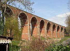
Le Mesnil-Villement
| Le Mesnil-Villement | |
|---|---|
 | |
 Le Mesnil-Villement | |
|
Location within Normandy region  Le Mesnil-Villement | |
| Coordinates: 48°51′14″N 0°22′09″W / 48.8539°N 0.3692°WCoordinates: 48°51′14″N 0°22′09″W / 48.8539°N 0.3692°W | |
| Country | France |
| Region | Normandy |
| Department | Calvados |
| Arrondissement | Caen |
| Canton | Falaise-Nord |
| Intercommunality | Pays de Falaise |
| Government | |
| • Mayor (2008–2014) | Roland Leroyer |
| Area1 | 3.55 km2 (1.37 sq mi) |
| Population (2008)2 | 292 |
| • Density | 82/km2 (210/sq mi) |
| Time zone | CET (UTC+1) |
| • Summer (DST) | CEST (UTC+2) |
| INSEE/Postal code | 14427 / 14690 |
| Elevation |
48–187 m (157–614 ft) (avg. 75 m or 246 ft) |
|
1 French Land Register data, which excludes lakes, ponds, glaciers > 1 km² (0.386 sq mi or 247 acres) and river estuaries. 2 Population without double counting: residents of multiple communes (e.g., students and military personnel) only counted once. | |
Le Mesnil-Villement is a commune in the Calvados department in the Normandy region in northwestern France.
Population
| Historical population | ||
|---|---|---|
| Year | Pop. | ±% |
| 1962 | 486 | — |
| 1968 | 456 | −6.2% |
| 1975 | 416 | −8.8% |
| 1982 | 354 | −14.9% |
| 1990 | 302 | −14.7% |
| 1999 | 283 | −6.3% |
| 2008 | 292 | +3.2% |
See also
References
| Wikimedia Commons has media related to Le Mesnil-Villement. |
This article is issued from Wikipedia - version of the 3/16/2016. The text is available under the Creative Commons Attribution/Share Alike but additional terms may apply for the media files.