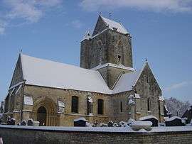
Condé-sur-Ifs
| Condé-sur-Ifs | |
|---|---|
 | |
 Condé-sur-Ifs | |
|
Location within Normandy region  Condé-sur-Ifs | |
| Coordinates: 49°02′37″N 0°07′32″W / 49.0436°N 0.1256°WCoordinates: 49°02′37″N 0°07′32″W / 49.0436°N 0.1256°W | |
| Country | France |
| Region | Normandy |
| Department | Calvados |
| Arrondissement | Caen |
| Canton | Bretteville-sur-Laize |
| Intercommunality | Vallée d'Auge |
| Government | |
| • Mayor (2008–2014) | Laurent Declerck |
| Area1 | 12 km2 (5 sq mi) |
| Population (2008)2 | 430 |
| • Density | 36/km2 (93/sq mi) |
| Time zone | CET (UTC+1) |
| • Summer (DST) | CEST (UTC+2) |
| INSEE/Postal code | 14173 / 14610 |
| Elevation | 28–81 m (92–266 ft) |
|
1 French Land Register data, which excludes lakes, ponds, glaciers > 1 km² (0.386 sq mi or 247 acres) and river estuaries. 2 Population without double counting: residents of multiple communes (e.g., students and military personnel) only counted once. | |
Condé-sur-Ifs is a commune in the Calvados department in the Normandy region in northwestern France. It is situated on the Ifs river.
Population
| Historical population | ||
|---|---|---|
| Year | Pop. | ±% |
| 1962 | 383 | — |
| 1968 | 361 | −5.7% |
| 1975 | 324 | −10.2% |
| 1982 | 350 | +8.0% |
| 1990 | 368 | +5.1% |
| 1999 | 351 | −4.6% |
| 2008 | 430 | +22.5% |
See also
References
| Wikimedia Commons has media related to Condé-sur-Ifs. |
This article is issued from Wikipedia - version of the 3/16/2016. The text is available under the Creative Commons Attribution/Share Alike but additional terms may apply for the media files.