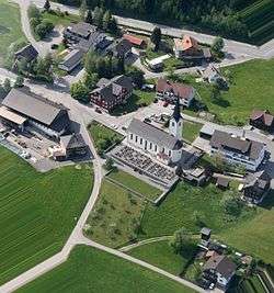
Langen bei Bregenz
| Langen bei Bregenz | ||
|---|---|---|
 | ||
| ||
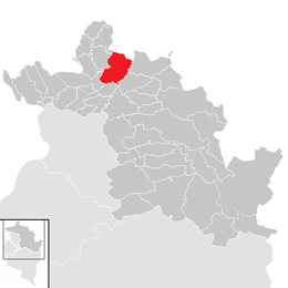
 Langen bei Bregenz Location within Austria | ||
Location in the district
| ||
| Coordinates: 47°30′28″N 09°49′37″E / 47.50778°N 9.82694°ECoordinates: 47°30′28″N 09°49′37″E / 47.50778°N 9.82694°E | ||
| Country | Austria | |
| State | Vorarlberg | |
| District | Bregenz | |
| Government | ||
| • Mayor | Josef Kirchmann | |
| Area | ||
| • Total | 21.88 km2 (8.45 sq mi) | |
| Elevation | 658 m (2,159 ft) | |
| Population (1 January 2016)[1] | ||
| • Total | 1,348 | |
| • Density | 62/km2 (160/sq mi) | |
| Time zone | CET (UTC+1) | |
| • Summer (DST) | CEST (UTC+2) | |
| Postal code | 6932 | |
| Area code | 05575 | |
| Vehicle registration | B | |
| Website | www.langen.at | |
Langen bei Bregenz is a municipality in the district of Bregenz in the Austrian state of Vorarlberg.
Population
| Historical population | ||
|---|---|---|
| Year | Pop. | ±% |
| 1869 | 727 | — |
| 1880 | 784 | +7.8% |
| 1890 | 649 | −17.2% |
| 1900 | 814 | +25.4% |
| 1910 | 679 | −16.6% |
| 1923 | 652 | −4.0% |
| 1934 | 651 | −0.2% |
| 1939 | 643 | −1.2% |
| 1951 | 712 | +10.7% |
| 1961 | 755 | +6.0% |
| 1971 | 845 | +11.9% |
| 1981 | 1,019 | +20.6% |
| 1991 | 1,194 | +17.2% |
| 2001 | 1,299 | +8.8% |
| 2011 | 1,305 | +0.5% |
References
- ↑ Statistik Austria - Bevölkerung zu Jahresbeginn 2002-2016 nach Gemeinden (Gebietsstand 1.1.2016) for Langen bei Bregenz.
| Wikimedia Commons has media related to Langen bei Bregenz. |
This article is issued from Wikipedia - version of the 6/8/2016. The text is available under the Creative Commons Attribution/Share Alike but additional terms may apply for the media files.