Casteil
| Casteil Castell de Vernet | ||
|---|---|---|
|
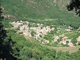
Casteil seen from the access road to the Abbey of Saint-Martin du Canigou | ||
| ||
 Casteil | ||
|
Location within Occitanie region  Casteil | ||
| Coordinates: 42°31′55″N 2°23′39″E / 42.5319°N 2.3942°ECoordinates: 42°31′55″N 2°23′39″E / 42.5319°N 2.3942°E | ||
| Country | France | |
| Region | Occitanie | |
| Department | Pyrénées-Orientales | |
| Arrondissement | Prades | |
| Canton | Le Canigou | |
| Intercommunality | Conflent | |
| Government | ||
| • Mayor (2014-2020) | Juliette Cases | |
| Area1 | 29.83 km2 (11.52 sq mi) | |
| Population (2013)2 | 134 | |
| • Density | 4.5/km2 (12/sq mi) | |
| Time zone | CET (UTC+1) | |
| • Summer (DST) | CEST (UTC+2) | |
| INSEE/Postal code | 66043 / 66820 | |
| Elevation |
697–2,721 m (2,287–8,927 ft) (avg. 750 m or 2,460 ft) | |
|
1 French Land Register data, which excludes lakes, ponds, glaciers > 1 km² (0.386 sq mi or 247 acres) and river estuaries. 2 Population without double counting: residents of multiple communes (e.g., students and military personnel) only counted once. | ||

Casteil (Catalan: Castell de Vernet) is a commune in the Pyrénées-Orientales department in southern France, part of the historical Conflent comarca. The abbey Martin-du-Canigou is located above Casteil.
Geography
Casteil is located in the canton of Prades and in the arrondissement of Prades.
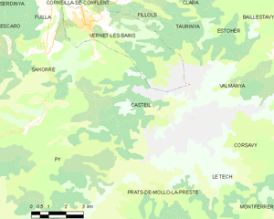
Map of Casteil and its surrounding communes
Population
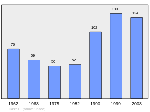
Population 1962-2008
See also
References
| Wikimedia Commons has media related to Casteil. |
This article is issued from Wikipedia - version of the 5/7/2016. The text is available under the Creative Commons Attribution/Share Alike but additional terms may apply for the media files.