Volpajola
| Volpajola A Vulpaiola | |
|---|---|
|
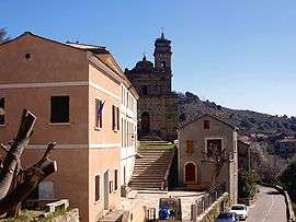
Town hall and church | |
 Volpajola | |
|
Location within Corsica region  Volpajola | |
| Coordinates: 42°31′35″N 9°21′29″E / 42.5264°N 9.3581°ECoordinates: 42°31′35″N 9°21′29″E / 42.5264°N 9.3581°E | |
| Country | France |
| Region | Corsica |
| Department | Haute-Corse |
| Arrondissement | Corte |
| Canton | Alto-di-Casaconi |
| Government | |
| • Mayor (2008–2014) | Annonciade Niellini |
| Area1 | 13 km2 (5 sq mi) |
| Population (2008)2 | 441 |
| • Density | 34/km2 (88/sq mi) |
| Time zone | CET (UTC+1) |
| • Summer (DST) | CEST (UTC+2) |
| INSEE/Postal code | 2B355 / 20290 |
| Elevation |
45–1,231 m (148–4,039 ft) (avg. 400 m or 1,300 ft) |
|
1 French Land Register data, which excludes lakes, ponds, glaciers > 1 km² (0.386 sq mi or 247 acres) and river estuaries. 2 Population without double counting: residents of multiple communes (e.g., students and military personnel) only counted once. | |
Volpajola is a commune in the Haute-Corse department of France on the island of Corsica.
It shares the canton of Alto-di-Casaconi with Monte, Campile, Olmo, Prunelli-di-Casacconi, Ortiporio, Campitello, Canavaggia, Lento, Bigorno, Scolca, Crocicchia and Penta-Acquatella.[1]
Geography
Volpajola is 6 kilometres (4 mi) to the east of Campitello. Its territory stretches over the left bank of the River Golo, through which runs Route N193 towards Bastia.
Population
| Historical population | ||
|---|---|---|
| Year | Pop. | ±% |
| 1962 | 479 | — |
| 1968 | 492 | +2.7% |
| 1975 | 460 | −6.5% |
| 1982 | 281 | −38.9% |
| 1990 | 275 | −2.1% |
| 1999 | 366 | +33.1% |
| 2008 | 441 | +20.5% |
See also
References
- ↑ "France, le trésor des régions: Département: Haut-Corse" (in French). Retrieved 2008-05-06..
| Wikimedia Commons has media related to Volpajola. |
This article is issued from Wikipedia - version of the 9/10/2016. The text is available under the Creative Commons Attribution/Share Alike but additional terms may apply for the media files.