Vendoire
| Vendoire | |
|---|---|
 | |
 Vendoire | |
|
Location within Nouvelle-Aquitaine region  Vendoire | |
| Coordinates: 45°24′58″N 0°18′13″E / 45.4161°N 0.3036°ECoordinates: 45°24′58″N 0°18′13″E / 45.4161°N 0.3036°E | |
| Country | France |
| Region | Nouvelle-Aquitaine |
| Department | Dordogne |
| Arrondissement | Périgueux |
| Canton | Verteillac |
| Intercommunality | Verteillacois |
| Government | |
| • Mayor (2008–2014) | Alain Lucas |
| Area1 | 11.65 km2 (4.50 sq mi) |
| Population (2008)2 | 149 |
| • Density | 13/km2 (33/sq mi) |
| Time zone | CET (UTC+1) |
| • Summer (DST) | CEST (UTC+2) |
| INSEE/Postal code | 24569 / 24320 |
| Elevation |
70–163 m (230–535 ft) (avg. 130 m or 430 ft) |
|
1 French Land Register data, which excludes lakes, ponds, glaciers > 1 km² (0.386 sq mi or 247 acres) and river estuaries. 2 Population without double counting: residents of multiple communes (e.g., students and military personnel) only counted once. | |
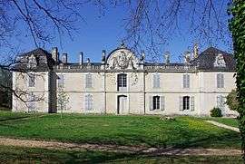
Vendoire is a commune in the Dordogne department in Nouvelle-Aquitaine in southwestern France.
Geography
The Lizonne forms the commune's northern and western borders.
Population
| Historical population | ||
|---|---|---|
| Year | Pop. | ±% |
| 1962 | 236 | — |
| 1968 | 183 | −22.5% |
| 1975 | 193 | +5.5% |
| 1982 | 176 | −8.8% |
| 1990 | 185 | +5.1% |
| 1999 | 149 | −19.5% |
| 2008 | 149 | +0.0% |
See also
References
| Wikimedia Commons has media related to Vendoire. |
This article is issued from Wikipedia - version of the 11/9/2016. The text is available under the Creative Commons Attribution/Share Alike but additional terms may apply for the media files.