Vanxains
| Vanxains | |
|---|---|
 | |
 Vanxains | |
|
Location within Nouvelle-Aquitaine region  Vanxains | |
| Coordinates: 45°13′00″N 0°17′17″E / 45.2167°N 0.2881°ECoordinates: 45°13′00″N 0°17′17″E / 45.2167°N 0.2881°E | |
| Country | France |
| Region | Nouvelle-Aquitaine |
| Department | Dordogne |
| Arrondissement | Périgueux |
| Canton | Ribérac |
| Intercommunality | Ribéracois |
| Government | |
| • Mayor (2008–2014) | Gilles Giroux |
| Area1 | 35.89 km2 (13.86 sq mi) |
| Population (2008)2 | 744 |
| • Density | 21/km2 (54/sq mi) |
| Time zone | CET (UTC+1) |
| • Summer (DST) | CEST (UTC+2) |
| INSEE/Postal code | 24564 / 24600 |
| Elevation |
52–161 m (171–528 ft) (avg. 110 m or 360 ft) |
|
1 French Land Register data, which excludes lakes, ponds, glaciers > 1 km² (0.386 sq mi or 247 acres) and river estuaries. 2 Population without double counting: residents of multiple communes (e.g., students and military personnel) only counted once. | |
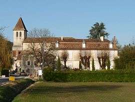
Vanxains is a commune in the Dordogne department in Nouvelle-Aquitaine in southwestern France. The Château de la Brangelie is located just southeast of the village.
Population
| Historical population | ||
|---|---|---|
| Year | Pop. | ±% |
| 1962 | 532 | — |
| 1968 | 641 | +20.5% |
| 1975 | 556 | −13.3% |
| 1982 | 591 | +6.3% |
| 1990 | 665 | +12.5% |
| 1999 | 665 | +0.0% |
| 2008 | 744 | +11.9% |
Sights
See also
References
External links
| Wikimedia Commons has media related to Vanxains. |
This article is issued from Wikipedia - version of the 11/9/2016. The text is available under the Creative Commons Attribution/Share Alike but additional terms may apply for the media files.