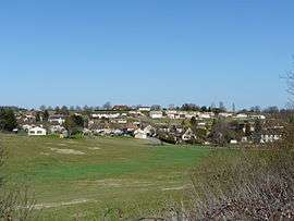
La Douze
| La Douze | |
|---|---|
 | |
 La Douze | |
|
Location within Nouvelle-Aquitaine region  La Douze | |
| Coordinates: 45°03′45″N 0°51′52″E / 45.0625°N 0.8644°ECoordinates: 45°03′45″N 0°51′52″E / 45.0625°N 0.8644°E | |
| Country | France |
| Region | Nouvelle-Aquitaine |
| Department | Dordogne |
| Arrondissement | Périgueux |
| Canton | Saint-Pierre-de-Chignac |
| Intercommunality | Isle Manoire en Périgord |
| Government | |
| • Mayor (2008–2014) | Jean-Claude Vibien |
| Area1 | 23.05 km2 (8.90 sq mi) |
| Population (2008)2 | 1,018 |
| • Density | 44/km2 (110/sq mi) |
| Time zone | CET (UTC+1) |
| • Summer (DST) | CEST (UTC+2) |
| INSEE/Postal code | 24156 / 24330 |
| Elevation |
132–267 m (433–876 ft) (avg. 200 m or 660 ft) |
|
1 French Land Register data, which excludes lakes, ponds, glaciers > 1 km² (0.386 sq mi or 247 acres) and river estuaries. 2 Population without double counting: residents of multiple communes (e.g., students and military personnel) only counted once. | |
La Douze is a commune in the Dordogne department in Nouvelle-Aquitaine in southwestern France.
Population
| Historical population | ||
|---|---|---|
| Year | Pop. | ±% |
| 1962 | 701 | — |
| 1968 | 693 | −1.1% |
| 1975 | 700 | +1.0% |
| 1982 | 801 | +14.4% |
| 1990 | 866 | +8.1% |
| 1999 | 910 | +5.1% |
| 2008 | 1,018 | +11.9% |
History
The lordship of La Douze was acquired in 1372 by the Abzac family. It was converted to a marquisate in 1615, which lasted until 1943.
On Cassini's map of France between 1756 and 1789, the village is identified by the name Ladouze.
See also
References
| Wikimedia Commons has media related to La Douze. |
This article is issued from Wikipedia - version of the 11/9/2016. The text is available under the Creative Commons Attribution/Share Alike but additional terms may apply for the media files.