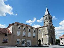
Firbeix
| Firbeix | |
|---|---|
 | |
 Firbeix | |
|
Location within Nouvelle-Aquitaine region  Firbeix | |
| Coordinates: 45°36′01″N 0°58′33″E / 45.6003°N 0.9758°ECoordinates: 45°36′01″N 0°58′33″E / 45.6003°N 0.9758°E | |
| Country | France |
| Region | Nouvelle-Aquitaine |
| Department | Dordogne |
| Arrondissement | Nontron |
| Canton | Saint-Pardoux-la-Rivière |
| Government | |
| • Mayor (2008–2014) | Christian Gorre |
| Area1 | 22.66 km2 (8.75 sq mi) |
| Population (2008)2 | 331 |
| • Density | 15/km2 (38/sq mi) |
| Time zone | CET (UTC+1) |
| • Summer (DST) | CEST (UTC+2) |
| INSEE/Postal code | 24180 / 24450 |
| Elevation |
290–451 m (951–1,480 ft) (avg. 360 m or 1,180 ft) |
|
1 French Land Register data, which excludes lakes, ponds, glaciers > 1 km² (0.386 sq mi or 247 acres) and river estuaries. 2 Population without double counting: residents of multiple communes (e.g., students and military personnel) only counted once. | |
Firbeix is a commune in the Dordogne department in Nouvelle-Aquitaine in southwestern France.
Geography
The Côle has its source near le Châtenet, a hamlet in the southern part of the commune; it forms part of the commune's southeastern border.
Population
| Historical population | ||
|---|---|---|
| Year | Pop. | ±% |
| 1962 | 553 | — |
| 1968 | 510 | −7.8% |
| 1975 | 448 | −12.2% |
| 1982 | 401 | −10.5% |
| 1990 | 364 | −9.2% |
| 1999 | 322 | −11.5% |
| 2008 | 331 | +2.8% |
See also
References
| Wikimedia Commons has media related to Firbeix. |
This article is issued from Wikipedia - version of the 11/9/2016. The text is available under the Creative Commons Attribution/Share Alike but additional terms may apply for the media files.