Mouret, Aveyron
| Mouret | |
|---|---|
|
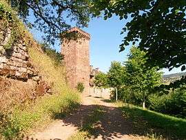
The Château of La Servairie | |
 Mouret | |
|
Location within Occitanie region  Mouret | |
| Coordinates: 44°31′05″N 2°30′56″E / 44.5181°N 2.5156°ECoordinates: 44°31′05″N 2°30′56″E / 44.5181°N 2.5156°E | |
| Country | France |
| Region | Occitanie |
| Department | Aveyron |
| Arrondissement | Rodez |
| Canton | Marcillac-Vallon |
| Intercommunality | Causse et Vallon de Marcillac |
| Government | |
| • Mayor (2008–2014) | Gabriel Issalys |
| Area1 | 31.61 km2 (12.20 sq mi) |
| Population (2008)2 | 538 |
| • Density | 17/km2 (44/sq mi) |
| Time zone | CET (UTC+1) |
| • Summer (DST) | CEST (UTC+2) |
| INSEE/Postal code | 12161 / 12330 |
| Elevation |
269–608 m (883–1,995 ft) (avg. 360 m or 1,180 ft) |
|
1 French Land Register data, which excludes lakes, ponds, glaciers > 1 km² (0.386 sq mi or 247 acres) and river estuaries. 2 Population without double counting: residents of multiple communes (e.g., students and military personnel) only counted once. | |
Mouret is a commune in the Aveyron department in southern France.
Population
| Historical population | ||
|---|---|---|
| Year | Pop. | ±% |
| 1962 | 562 | — |
| 1968 | 594 | +5.7% |
| 1975 | 545 | −8.2% |
| 1982 | 505 | −7.3% |
| 1990 | 464 | −8.1% |
| 1999 | 476 | +2.6% |
| 2008 | 538 | +13.0% |
See also
References
| Wikimedia Commons has media related to Mouret (Aveyron). |
This article is issued from Wikipedia - version of the 3/9/2015. The text is available under the Creative Commons Attribution/Share Alike but additional terms may apply for the media files.