Montcenis
Not to be confused with Mont Cenis.
| Montcenis | ||
|---|---|---|
|
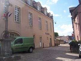
Town hall | ||
| ||
 Montcenis | ||
|
Location within Bourgogne-Franche-Comté region  Montcenis | ||
| Coordinates: 46°47′29″N 4°23′23″E / 46.7914°N 4.3897°ECoordinates: 46°47′29″N 4°23′23″E / 46.7914°N 4.3897°E | ||
| Country | France | |
| Region | Bourgogne-Franche-Comté | |
| Department | Saône-et-Loire | |
| Arrondissement | Autun | |
| Canton | Montcenis | |
| Intercommunality | Creusot-Montceau | |
| Government | ||
| • Mayor (2001–2008) | Michel Rey | |
| Area1 | 12.33 km2 (4.76 sq mi) | |
| Population (2006)2 | 2,245 | |
| • Density | 180/km2 (470/sq mi) | |
| Time zone | CET (UTC+1) | |
| • Summer (DST) | CEST (UTC+2) | |
| INSEE/Postal code | 71309 / 71710 | |
| Elevation |
310–513 m (1,017–1,683 ft) (avg. 420 m or 1,380 ft) | |
|
1 French Land Register data, which excludes lakes, ponds, glaciers > 1 km² (0.386 sq mi or 247 acres) and river estuaries. 2 Population without double counting: residents of multiple communes (e.g., students and military personnel) only counted once. | ||

Montcenis is a commune in the Saône-et-Loire department in the region of Bourgogne in eastern France.
Geography
The Bourbince river has its source in the commune.
See also
References
| Wikimedia Commons has media related to Montcenis. |
This article is issued from Wikipedia - version of the 10/28/2016. The text is available under the Creative Commons Attribution/Share Alike but additional terms may apply for the media files.