Mazères, Ariège
| Mazères | ||
|---|---|---|
|
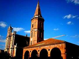
The church in Mazères | ||
| ||
 Mazères | ||
|
Location within Occitanie region  Mazères | ||
| Coordinates: 43°15′09″N 1°40′44″E / 43.2525°N 1.6789°ECoordinates: 43°15′09″N 1°40′44″E / 43.2525°N 1.6789°E | ||
| Country | France | |
| Region | Occitanie | |
| Department | Ariège | |
| Arrondissement | Pamiers | |
| Canton | Saverdun | |
| Intercommunality | Canton of Saverdun | |
| Government | ||
| • Mayor (2008–2014) | Louis Marette | |
| Area1 | 44.04 km2 (17.00 sq mi) | |
| Population (2008)2 | 3,413 | |
| • Density | 77/km2 (200/sq mi) | |
| Time zone | CET (UTC+1) | |
| • Summer (DST) | CEST (UTC+2) | |
| INSEE/Postal code | 09185 / 09270 | |
| Elevation |
218–333 m (715–1,093 ft) (avg. 243 m or 797 ft) | |
|
1 French Land Register data, which excludes lakes, ponds, glaciers > 1 km² (0.386 sq mi or 247 acres) and river estuaries. 2 Population without double counting: residents of multiple communes (e.g., students and military personnel) only counted once. | ||
.svg.png)
Mazères is a commune in the Ariège department in southwestern France.
Population
| Historical population | ||
|---|---|---|
| Year | Pop. | ±% |
| 1962 | 2,140 | — |
| 1968 | 2,192 | +2.4% |
| 1975 | 2,071 | −5.5% |
| 1982 | 2,355 | +13.7% |
| 1990 | 2,519 | +7.0% |
| 1999 | 2,616 | +3.9% |
| 2008 | 3,413 | +30.5% |
See also
References
| Wikimedia Commons has media related to Mazères, Ariège. |
This article is issued from Wikipedia - version of the 7/20/2016. The text is available under the Creative Commons Attribution/Share Alike but additional terms may apply for the media files.