Loubens, Ariège
| Loubens | |
|---|---|
|
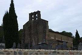
The church in Loubens | |
 Loubens | |
|
Location within Occitanie region  Loubens | |
| Coordinates: 43°02′46″N 1°32′47″E / 43.0461°N 1.5464°ECoordinates: 43°02′46″N 1°32′47″E / 43.0461°N 1.5464°E | |
| Country | France |
| Region | Occitanie |
| Department | Ariège |
| Arrondissement | Pamiers |
| Canton | Varilhes |
| Intercommunality | Canton of Varilhes |
| Government | |
| • Mayor (2008–2014) | Roger Sicre |
| Area1 | 11.73 km2 (4.53 sq mi) |
| Population (2008)2 | 254 |
| • Density | 22/km2 (56/sq mi) |
| Time zone | CET (UTC+1) |
| • Summer (DST) | CEST (UTC+2) |
| INSEE/Postal code | 09173 / 09120 |
| Elevation |
382–702 m (1,253–2,303 ft) (avg. 420 m or 1,380 ft) |
|
1 French Land Register data, which excludes lakes, ponds, glaciers > 1 km² (0.386 sq mi or 247 acres) and river estuaries. 2 Population without double counting: residents of multiple communes (e.g., students and military personnel) only counted once. | |
Loubens (Occitan: Lobenç) is a commune in the Ariège department in southwestern France.
Population
| Historical population | ||
|---|---|---|
| Year | Pop. | ±% |
| 1962 | 176 | — |
| 1968 | 189 | +7.4% |
| 1975 | 150 | −20.6% |
| 1982 | 151 | +0.7% |
| 1990 | 183 | +21.2% |
| 1999 | 200 | +9.3% |
| 2008 | 254 | +27.0% |
See also
References
| Wikimedia Commons has media related to Loubens (Ariège). |
This article is issued from Wikipedia - version of the 7/16/2016. The text is available under the Creative Commons Attribution/Share Alike but additional terms may apply for the media files.