Labastide-du-Vert
| Labastide-du-Vert | |
|---|---|
|
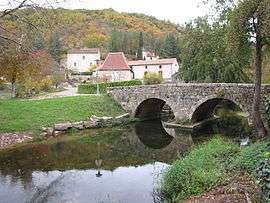
The old bridge over the Vert, in Labastide-du-Vert | |
 Labastide-du-Vert | |
|
Location within Occitanie region  Labastide-du-Vert | |
| Coordinates: 44°30′45″N 1°15′47″E / 44.5125°N 1.2631°ECoordinates: 44°30′45″N 1°15′47″E / 44.5125°N 1.2631°E | |
| Country | France |
| Region | Occitanie |
| Department | Lot |
| Arrondissement | Arrondissement of Cahors |
| Canton | Canton of Catus |
| Intercommunality | Communauté de communes de Catus |
| Government | |
| • Mayor (2001–2008) | Jean-Pierre Labro |
| Area1 | 10.44 km2 (4.03 sq mi) |
| Population (1999)2 | 215 |
| • Density | 21/km2 (53/sq mi) |
| Time zone | CET (UTC+1) |
| • Summer (DST) | CEST (UTC+2) |
| INSEE/Postal code | 46136 / 46150 |
| Elevation |
102–283 m (335–928 ft) (avg. 121 m or 397 ft) |
|
1 French Land Register data, which excludes lakes, ponds, glaciers > 1 km² (0.386 sq mi or 247 acres) and river estuaries. 2 Population without double counting: residents of multiple communes (e.g., students and military personnel) only counted once. | |
Labastide-du-Vert is a commune in the Lot department in south-western France.
See also
| Wikimedia Commons has media related to Labastide-du-Vert. |
This article is issued from Wikipedia - version of the 2/11/2016. The text is available under the Creative Commons Attribution/Share Alike but additional terms may apply for the media files.