La Valla-en-Gier
| La Valla-en-Gier | |
|---|---|
|
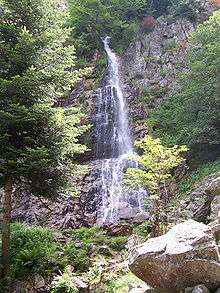
The Saut du Gier waterfall | |
 La Valla-en-Gier | |
|
Location within Auvergne-Rhône-Alpes region  La Valla-en-Gier | |
| Coordinates: 45°25′00″N 4°31′01″E / 45.4167°N 4.5169°ECoordinates: 45°25′00″N 4°31′01″E / 45.4167°N 4.5169°E | |
| Country | France |
| Region | Auvergne-Rhône-Alpes |
| Department | Loire |
| Arrondissement | Saint-Étienne |
| Canton | Saint-Chamond-Sud |
| Intercommunality | Communauté d'agglomération Saint-Étienne Métropole |
| Government | |
| • Mayor (2008–2014) | Jean-Claude Flachat |
| Area1 | 34.78 km2 (13.43 sq mi) |
| Population (1999)2 | 741 |
| • Density | 21/km2 (55/sq mi) |
| Time zone | CET (UTC+1) |
| • Summer (DST) | CEST (UTC+2) |
| INSEE/Postal code | 42322 / 42131 |
| Elevation |
440–1,388 m (1,444–4,554 ft) (avg. 650 m or 2,130 ft) |
|
1 French Land Register data, which excludes lakes, ponds, glaciers > 1 km² (0.386 sq mi or 247 acres) and river estuaries. 2 Population without double counting: residents of multiple communes (e.g., students and military personnel) only counted once. | |
La Valla-en-Gier is a commune in the Loire department in central France.
See also
| Wikimedia Commons has media related to La Valla-en-Gier. |
This article is issued from Wikipedia - version of the 10/28/2016. The text is available under the Creative Commons Attribution/Share Alike but additional terms may apply for the media files.