Gomené
| Gomené Gouvene | ||
|---|---|---|
| ||
 Gomené | ||
|
Location within Brittany region 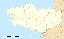 Gomené | ||
| Coordinates: 48°10′29″N 2°29′09″W / 48.1747°N 2.4858°WCoordinates: 48°10′29″N 2°29′09″W / 48.1747°N 2.4858°W | ||
| Country | France | |
| Region | Brittany | |
| Department | Côtes-d'Armor | |
| Arrondissement | Dinan | |
| Canton | Merdrignac | |
| Intercommunality | Hardouinais Mené | |
| Government | ||
| • Mayor (2014–2020) | Mickaël Leveau | |
| Area1 | 25.37 km2 (9.80 sq mi) | |
| Population (2008)2 | 598 | |
| • Density | 24/km2 (61/sq mi) | |
| Time zone | CET (UTC+1) | |
| • Summer (DST) | CEST (UTC+2) | |
| INSEE/Postal code | 22062 / 22230 | |
| Elevation | 104–221 m (341–725 ft) | |
|
1 French Land Register data, which excludes lakes, ponds, glaciers > 1 km² (0.386 sq mi or 247 acres) and river estuaries. 2 Population without double counting: residents of multiple communes (e.g., students and military personnel) only counted once. | ||
.svg.png)
Gomené (Breton: Gouvene, Gallo: Gómenaé) is a commune in the Côtes-d'Armor department of Brittany in northwestern France.
Population
Inhabitants of Gomené are called goménéens in French.
| Historical population | ||
|---|---|---|
| Year | Pop. | ±% |
| 1962 | 595 | — |
| 1968 | 718 | +20.7% |
| 1975 | 647 | −9.9% |
| 1982 | 596 | −7.9% |
| 1990 | 535 | −10.2% |
| 1999 | 539 | +0.7% |
| 2008 | 598 | +10.9% |
See also
References
| Wikimedia Commons has media related to Gomené. |
This article is issued from Wikipedia - version of the 5/8/2014. The text is available under the Creative Commons Attribution/Share Alike but additional terms may apply for the media files.