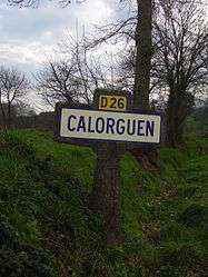
Calorguen
| Calorguen Kerorgen | ||
|---|---|---|
 | ||
| ||
 Calorguen | ||
|
Location within Brittany region 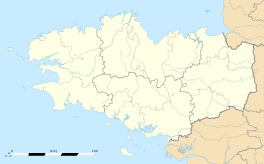 Calorguen | ||
| Coordinates: 48°24′38″N 2°01′39″W / 48.4105°N 2.0275°WCoordinates: 48°24′38″N 2°01′39″W / 48.4105°N 2.0275°W | ||
| Country | France | |
| Region | Brittany | |
| Department | Côtes-d'Armor | |
| Arrondissement | Dinan | |
| Canton | Dinan-Ouest | |
| Intercommunality | Dinan | |
| Government | ||
| • Mayor (2014–2020) | Alain Martin | |
| Area1 | 8.48 km2 (3.27 sq mi) | |
| Population (2008)2 | 665 | |
| • Density | 78/km2 (200/sq mi) | |
| Time zone | CET (UTC+1) | |
| • Summer (DST) | CEST (UTC+2) | |
| INSEE/Postal code | 22026 / 22100 | |
| Elevation | 7–87 m (23–285 ft) | |
|
1 French Land Register data, which excludes lakes, ponds, glaciers > 1 km² (0.386 sq mi or 247 acres) and river estuaries. 2 Population without double counting: residents of multiple communes (e.g., students and military personnel) only counted once. | ||
.svg.png)
Calorguen (Breton: Kerorgen, Gallo: Calorgen) is a commune in the Côtes-d'Armor department of Brittany in northwestern France.
Population
Inhabitants of Calorguen are called in French Calorguennais.
| Historical population | ||
|---|---|---|
| Year | Pop. | ±% |
| 1794 | 857 | — |
| 1820 | 775 | −9.6% |
| 1841 | 900 | +16.1% |
| 1851 | 918 | +2.0% |
| 1872 | 871 | −5.1% |
| 1891 | 795 | −8.7% |
| 1901 | 732 | −7.9% |
| 1906 | 749 | +2.3% |
| 1911 | 699 | −6.7% |
| 1921 | 617 | −11.7% |
| 1926 | 584 | −5.3% |
| 1931 | 590 | +1.0% |
| 1936 | 555 | −5.9% |
| 1946 | 505 | −9.0% |
| 1954 | 516 | +2.2% |
| 1962 | 507 | −1.7% |
| 1968 | 506 | −0.2% |
| 1975 | 450 | −11.1% |
| 1982 | 497 | +10.4% |
| 1990 | 508 | +2.2% |
| 1999 | 523 | +3.0% |
| 2008 | 665 | +27.2% |
See also
References
External links
| Wikimedia Commons has media related to Calorguen. |
This article is issued from Wikipedia - version of the 3/15/2016. The text is available under the Creative Commons Attribution/Share Alike but additional terms may apply for the media files.