Ullastret
| Ullastret | ||
|---|---|---|
| Municipality | ||
 | ||
| ||
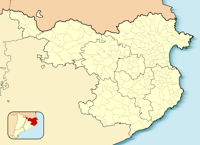 Ullastret 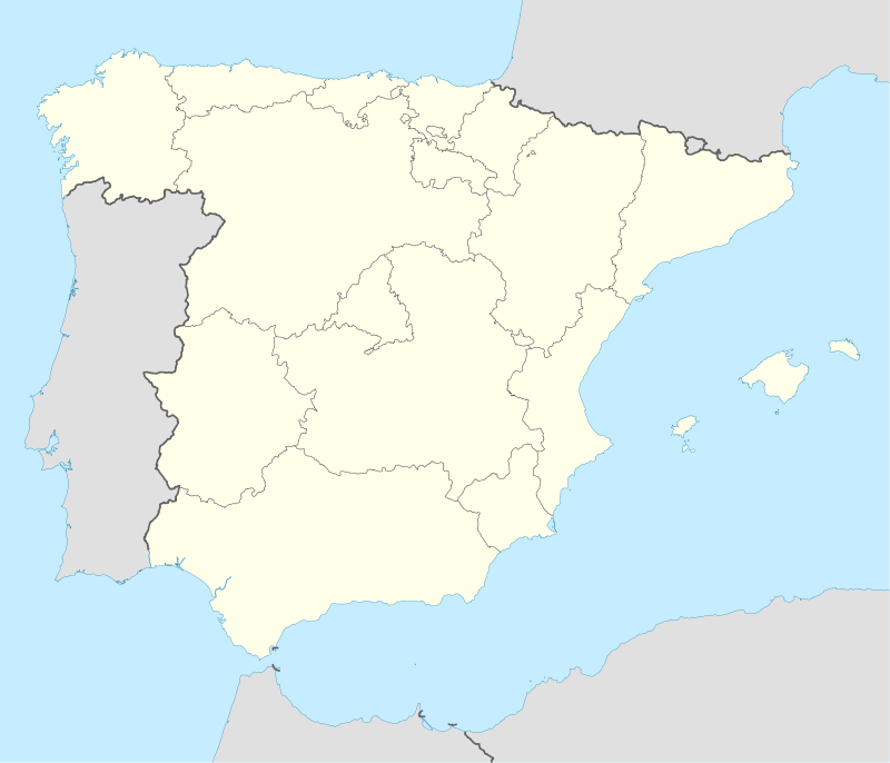 Ullastret Location in Catalonia | ||
| Coordinates: 42°00′02″N 3°04′07″E / 42.000548°N 3.068483°E | ||
| Country |
| |
| Community |
| |
| Province | Girona | |
| Comarca | Baix Empordà | |
| Government | ||
| • Mayor | Josep Miquel Gatius Callís (2015)[1] | |
| Area[2] | ||
| • Total | 11.1 km2 (4.3 sq mi) | |
| Elevation | 49 m (161 ft) | |
| Population (2014)[1] | ||
| • Total | 289 | |
| • Density | 26/km2 (67/sq mi) | |
| Website |
www | |
Ullastret is a small historic village on the Bay of Emporda located some 5 km northeast of La Bisbal d'Empordà.
Formerly a 3 km2 lake, known as Llac d'Ullastret or Estany d'Ullastret existed close to this town, but it was desiccated in the 19th century.[3]
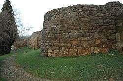
It is home to ancient Iberian archaeological remains, and a medieval church known from the 9th century, dedicated to St. Paul and Peter. Economy is based mostly on tourism and agriculture.
References
- 1 2 "Ajuntament d'Ullastret". Generalitat of Catalonia. Retrieved 2015-11-13.
- ↑ "El municipi en xifres: Ullastret". Statistical Institute of Catalonia. Retrieved 2015-11-23.
- ↑ Ullastret - Poblat Ibèric l'Illa d'en Reixac
 |
Parlavà | Serra de Daró | Fontanilles | |
| Corçà | |
Palau-sator | ||
| ||||
| | ||||
| La Bisbal d'Empordà | Forallac |
This article is issued from Wikipedia - version of the 11/10/2016. The text is available under the Creative Commons Attribution/Share Alike but additional terms may apply for the media files.