Ménesqueville
| Ménesqueville | |
|---|---|
|
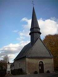
Church of Saint-Aubin | |
 Ménesqueville | |
|
Location within Normandy region  Ménesqueville | |
| Coordinates: 49°21′49″N 1°24′42″E / 49.3636°N 1.4117°ECoordinates: 49°21′49″N 1°24′42″E / 49.3636°N 1.4117°E | |
| Country | France |
| Region | Normandy |
| Department | Eure |
| Arrondissement | Les Andelys |
| Canton | Fleury-sur-Andelle |
| Intercommunality | Communauté de communes de l'Andelle |
| Government | |
| • Mayor (2014-2020) | Christian Lefebvre |
| Area1 | 4.17 km2 (1.61 sq mi) |
| Population (2011)2 | 440 |
| • Density | 110/km2 (270/sq mi) |
| Time zone | CET (UTC+1) |
| • Summer (DST) | CEST (UTC+2) |
| INSEE/Postal code | 27396 / 27850 |
| Elevation |
41–131 m (135–430 ft) (avg. 83 m or 272 ft) |
|
1 French Land Register data, which excludes lakes, ponds, glaciers > 1 km² (0.386 sq mi or 247 acres) and river estuaries. 2 Population without double counting: residents of multiple communes (e.g., students and military personnel) only counted once. | |
Ménesqueville is a commune in the Eure department and Haute-Normandie region of north-western France.
Population
| Historical population | ||
|---|---|---|
| Year | Pop. | ±% |
| 1793 | 220 | — |
| 1821 | 194 | −11.8% |
| 1851 | 171 | −11.9% |
| 1962 | 282 | +64.9% |
| 1968 | 355 | +25.9% |
| 1975 | 345 | −2.8% |
| 1982 | 387 | +12.2% |
| 1990 | 358 | −7.5% |
| 1999 | 349 | −2.5% |
| 2006 | 397 | +13.8% |
| 2007 | 404 | +1.8% |
| 2011 | 440 | +8.9% |
See also
References
| Wikimedia Commons has media related to Ménesqueville. |
This article is issued from Wikipedia - version of the 5/28/2014. The text is available under the Creative Commons Attribution/Share Alike but additional terms may apply for the media files.