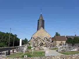
Armentières-sur-Avre
| Armentières-sur-Avre | |
|---|---|
 | |
 Armentières-sur-Avre | |
|
Location within Normandy region  Armentières-sur-Avre | |
| Coordinates: 48°41′06″N 0°48′36″E / 48.685°N 0.81°ECoordinates: 48°41′06″N 0°48′36″E / 48.685°N 0.81°E | |
| Country | France |
| Region | Normandy |
| Department | Eure |
| Arrondissement | Évreux |
| Canton | Verneuil-sur-Avre |
| Intercommunality | Pays de Verneuil-sur-Avre |
| Government | |
| • Mayor (2008–2014) | Jean-Etienne Morel |
| Area1 | 6.11 km2 (2.36 sq mi) |
| Population (2008)2 | 177 |
| • Density | 29/km2 (75/sq mi) |
| Time zone | CET (UTC+1) |
| • Summer (DST) | CEST (UTC+2) |
| INSEE/Postal code | 27019 / 27820 |
| Elevation | 174–208 m (571–682 ft) |
|
1 French Land Register data, which excludes lakes, ponds, glaciers > 1 km² (0.386 sq mi or 247 acres) and river estuaries. 2 Population without double counting: residents of multiple communes (e.g., students and military personnel) only counted once. | |
Armentières-sur-Avre is a commune in the Eure department in Haute-Normandie in northern France.
Population
| Historical population | ||
|---|---|---|
| Year | Pop. | ±% |
| 1962 | 160 | — |
| 1968 | 163 | +1.9% |
| 1975 | 178 | +9.2% |
| 1982 | 132 | −25.8% |
| 1990 | 142 | +7.6% |
| 1999 | 163 | +14.8% |
| 2008 | 177 | +8.6% |
See also
References
| Wikimedia Commons has media related to Armentières-sur-Avre. |
This article is issued from Wikipedia - version of the 9/16/2015. The text is available under the Creative Commons Attribution/Share Alike but additional terms may apply for the media files.