La Heunière
| La Heunière | |
|---|---|
 | |
 La Heunière | |
|
Location within Normandy region  La Heunière | |
| Coordinates: 49°03′44″N 1°24′54″E / 49.0622°N 1.415°ECoordinates: 49°03′44″N 1°24′54″E / 49.0622°N 1.415°E | |
| Country | France |
| Region | Normandy |
| Department | Eure |
| Arrondissement | Évreux |
| Canton | Vernon-Sud |
| Intercommunality | Portes de l'Eure |
| Government | |
| • Mayor (2008–2014) | Daniel Boutry |
| Area1 | 3.07 km2 (1.19 sq mi) |
| Population (2008)2 | 253 |
| • Density | 82/km2 (210/sq mi) |
| Time zone | CET (UTC+1) |
| • Summer (DST) | CEST (UTC+2) |
| INSEE/Postal code | 27336 / 27950 |
| Elevation |
122–143 m (400–469 ft) (avg. 142 m or 466 ft) |
|
1 French Land Register data, which excludes lakes, ponds, glaciers > 1 km² (0.386 sq mi or 247 acres) and river estuaries. 2 Population without double counting: residents of multiple communes (e.g., students and military personnel) only counted once. | |
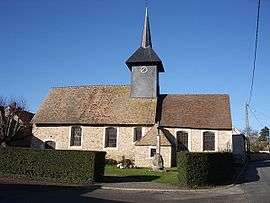
La Heunière is a commune in the Eure department in northern France.
Population
| Historical population | ||
|---|---|---|
| Year | Pop. | ±% |
| 1962 | 110 | — |
| 1968 | 126 | +14.5% |
| 1975 | 135 | +7.1% |
| 1982 | 195 | +44.4% |
| 1990 | 234 | +20.0% |
| 1999 | 241 | +3.0% |
| 2008 | 253 | +5.0% |
See also
References
| Wikimedia Commons has media related to La Heunière. |
This article is issued from Wikipedia - version of the 2/11/2016. The text is available under the Creative Commons Attribution/Share Alike but additional terms may apply for the media files.