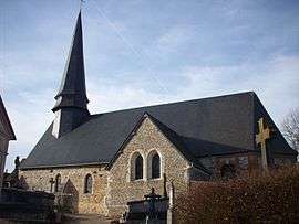
Bézu-la-Forêt
| Bézu-la-Forêt | |
|---|---|
 | |
 Bézu-la-Forêt | |
|
Location within Normandy region  Bézu-la-Forêt | |
| Coordinates: 49°24′08″N 1°37′52″E / 49.4022°N 1.6311°ECoordinates: 49°24′08″N 1°37′52″E / 49.4022°N 1.6311°E | |
| Country | France |
| Region | Normandy |
| Department | Eure |
| Arrondissement | Les Andelys |
| Canton | Lyons-la-Forêt |
| Government | |
| • Mayor (2008–2014) | Serge Briere |
| Area1 | 8.98 km2 (3.47 sq mi) |
| Population (2008)2 | 217 |
| • Density | 24/km2 (63/sq mi) |
| Time zone | CET (UTC+1) |
| • Summer (DST) | CEST (UTC+2) |
| INSEE/Postal code | 27066 / 27480 |
| Elevation |
107–160 m (351–525 ft) (avg. 154 m or 505 ft) |
|
1 French Land Register data, which excludes lakes, ponds, glaciers > 1 km² (0.386 sq mi or 247 acres) and river estuaries. 2 Population without double counting: residents of multiple communes (e.g., students and military personnel) only counted once. | |
Bézu-la-Forêt is a commune in the Eure department and Haute-Normandie region of France.
Population
| Historical population | ||
|---|---|---|
| Year | Pop. | ±% |
| 1868 | 424 | — |
| 1962 | 210 | −50.5% |
| 1968 | 234 | +11.4% |
| 1975 | 182 | −22.2% |
| 1982 | 167 | −8.2% |
| 1990 | 144 | −13.8% |
| 1999 | 188 | +30.6% |
| 2008 | 217 | +15.4% |
See also
References
| Wikimedia Commons has media related to Bézu-la-Forêt. |
This article is issued from Wikipedia - version of the 2/12/2016. The text is available under the Creative Commons Attribution/Share Alike but additional terms may apply for the media files.