Jakabszállás
| Jakabszállás | |
|---|---|
| Country |
|
| County | Bács-Kiskun |
| Area | |
| • Total | 70.86 km2 (27.36 sq mi) |
| Population (2005) | |
| • Total | 2,634 |
| • Density | 37/km2 (100/sq mi) |
| Time zone | CET (UTC+1) |
| • Summer (DST) | CEST (UTC+2) |
| Postal code | 6078 |
| Area code(s) | 76 |
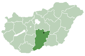
Location of Bács-Kiskun
county in Hungary
Jakabszállás is a village in Bács-Kiskun county, in the Southern Great Plain region of Hungary.
Geography
It covers an area of 70.86 km2 (27 sq mi) and has a population of 2634 people (2005).
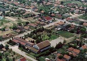
Aerialphotography of Jakabszállás
Coordinates: 46°45′42″N 19°36′04″E / 46.76167°N 19.60111°E
This article is issued from Wikipedia - version of the 2/4/2014. The text is available under the Creative Commons Attribution/Share Alike but additional terms may apply for the media files.