Héron
| Héron | ||
|---|---|---|
| Municipality | ||
.jpg) | ||
| ||
 Héron Location in Belgium | ||
|
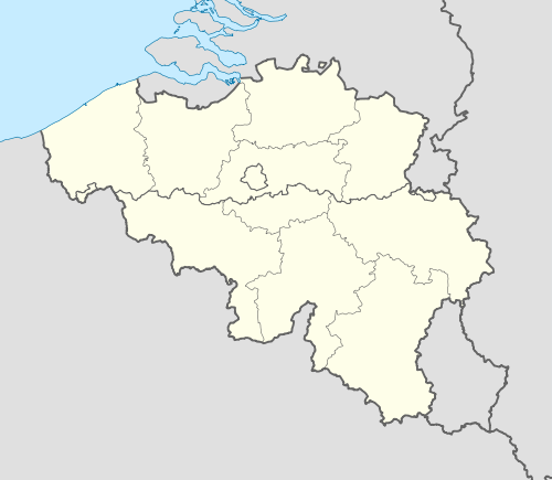
Location of Héron in the province of Liège 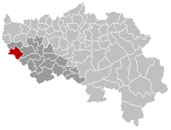 | ||
| Coordinates: 50°33′N 05°05′E / 50.550°N 5.083°ECoordinates: 50°33′N 05°05′E / 50.550°N 5.083°E | ||
| Country | Belgium | |
| Community | French Community | |
| Region | Wallonia | |
| Province | Liège | |
| Arrondissement | Huy | |
| Government | ||
| • Mayor | Eric Hautphenne (PSH) | |
| • Governing party/ies | PSH, Renouveau | |
| Area | ||
| • Total | 38.32 km2 (14.80 sq mi) | |
| Population (1 January 2016)[1] | ||
| • Total | 5,178 | |
| • Density | 140/km2 (350/sq mi) | |
| Postal codes | 4217, 4218 | |
| Area codes | 085 | |
| Website | www.heron.be | |

Héron is a Walloon municipality located in the Belgian province of Liège and the Huy-Ware district.
Geography
Héron is located on the river Mehaigne.
The municipality consists of the following sub-municipalities: Héron proper, Lavoir, Waret-l'Évêque, and Couthuin.
Demography
On January 1, 2006, Héron had a total population of 4,534. The total area is 38.32 km2 which gives a population density of 118 inhabitants per km2.
Facilities
Heron is home to Couthuin Airport.
Gallery
 Saint Hubertus church in Lavoir
.jpg) Potesta castle in Envoz
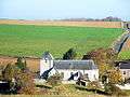
Potesta castle in Envoz.jpg) Typical old farm in Héron (17th century).
Typical old farm in Héron (17th century).
References
- ↑ Population per municipality as of 1 January 2016 (XLS; 397 KB)
External links
-
 Media related to Héron at Wikimedia Commons
 - Official website
 |
Burdinne | | ||
| Fernelmont (WNA) | |
Wanze | ||
| ||||
| | ||||
| Andenne (WNA) |
Municipalities of the Province of Liège | ||
|---|---|---|
| Huy |  | |
| Liège | ||
| Verviers | ||
| Waremme | ||
This article is issued from Wikipedia - version of the 12/1/2016. The text is available under the Creative Commons Attribution/Share Alike but additional terms may apply for the media files.