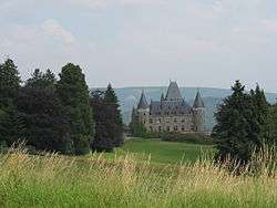
Stoumont
| Stoumont | ||
|---|---|---|
| Municipality | ||
 | ||
| ||
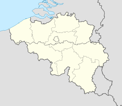 Stoumont Location in Belgium | ||
|
Location of Stoumont in the province of Liège 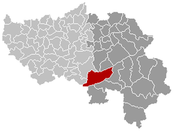 | ||
| Coordinates: 50°25′N 05°48′E / 50.417°N 5.800°ECoordinates: 50°25′N 05°48′E / 50.417°N 5.800°E | ||
| Country | Belgium | |
| Community | French Community | |
| Region | Wallonia | |
| Province | Liège | |
| Arrondissement | Verviers | |
| Government | ||
| • Mayor | José Dupont | |
| Area | ||
| • Total | 108.45 km2 (41.87 sq mi) | |
| Population (1 January 2016)[1] | ||
| • Total | 3,113 | |
| • Density | 29/km2 (74/sq mi) | |
| Postal codes | 4987 | |
| Area codes | 080 | |
| Website | www.stoumont.be | |

Stoumont is a municipality of Belgium. It lies in the country's Walloon Region and Province of Liege. On January 1, 2006, Stoumont had a total population of 3,006. The total area is 108.45 km² which gives a population density of 28 inhabitants per km².
The municipality consists of the following sub-municipalities: Stoumont proper, Chevron, La Gleize, Lorcé, and Rahier.
See also
References
- ↑ Population per municipality as of 1 January 2016 (XLS; 397 KB)
External links
-
 Media related to Stoumont at Wikimedia Commons
 |
Aywaille | Theux, Spa | | |
| Ferrières | |
Stavelot | ||
| ||||
| | ||||
| Manhay (WLX) | Lierneux, Trois-Ponts |
Municipalities of the Province of Liège | ||
|---|---|---|
| Huy |  | |
| Liège | ||
| Verviers | ||
| Waremme | ||
This article is issued from Wikipedia - version of the 12/1/2016. The text is available under the Creative Commons Attribution/Share Alike but additional terms may apply for the media files.