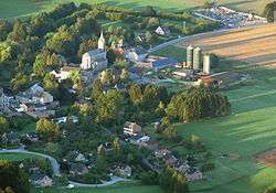
Ferrières, Belgium
| Ferrières | ||
|---|---|---|
| Municipality | ||
 | ||
| ||
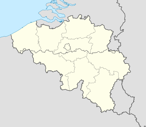 Ferrières Location in Belgium | ||
|
Location of Ferrières in the province of Liège 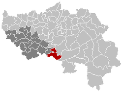 | ||
| Coordinates: 50°24′N 05°36′E / 50.400°N 5.600°ECoordinates: 50°24′N 05°36′E / 50.400°N 5.600°E | ||
| Country | Belgium | |
| Community | French Community | |
| Region | Wallonia | |
| Province | Liège | |
| Arrondissement | Huy | |
| Government | ||
| • Mayor | Frédéric LEONARD (RpF) | |
| • Governing party/ies | RpF | |
| Area | ||
| • Total | 56.90 km2 (21.97 sq mi) | |
| Population (1 January 2016)[1] | ||
| • Total | 4,847 | |
| • Density | 85/km2 (220/sq mi) | |
| Postal codes | 4190 | |
| Area codes | 086 and 04 | |
| Website | www.ferrieres.be | |
.svg.png)
Ferrières is a Walloon municipality located in the Belgian province of Liège. On January 1, 2006, Ferrières had a total population of 4,449. The total area is 56.90 km² with a population density of 78 inhabitants per km².
Sections of the municipality
- My (pronounced "Mee")
- Vieuxville
- Werbomont
- Xhoris
See also
References
- ↑ Population per municipality as of 1 January 2016 (XLS; 397 KB)
External links
-
 Media related to Ferrières, Belgium at Wikimedia Commons
 |
Hamoir | Comblain-au-Pont | Aywaille | |
| |
Stoumont | |||
| ||||
| | ||||
| Durbuy (WLX) | Manhay (WLX) |
Municipalities of the Province of Liège | ||
|---|---|---|
| Huy | 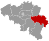 | |
| Liège | ||
| Verviers | ||
| Waremme | ||
This article is issued from Wikipedia - version of the 12/1/2016. The text is available under the Creative Commons Attribution/Share Alike but additional terms may apply for the media files.