Jalhay
| Jalhay | |
|---|---|
| Municipality | |
|
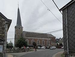
The Saint Michael's church (twisted church tower). | |
 Jalhay Location in Belgium | |
|
Location of Jalhay in the province of Liège 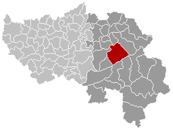 | |
| Coordinates: 50°34′N 05°58′E / 50.567°N 5.967°ECoordinates: 50°34′N 05°58′E / 50.567°N 5.967°E | |
| Country | Belgium |
| Community | French Community |
| Region | Wallonia |
| Province | Liège |
| Arrondissement | Verviers |
| Government | |
| • Mayor | Claude Grégoire |
| Area | |
| • Total | 107.75 km2 (41.60 sq mi) |
| Population (1 January 2016)[1] | |
| • Total | 8,566 |
| • Density | 79/km2 (210/sq mi) |
| Postal codes | 4845 |
| Area codes | 087 |
| Website | www.jalhay.be |
Jalhay is a municipality of Belgium. It lies in the country's Walloon Region and Province of Liege. On January 1, 2006, Jalhay had a total population of 7,953. The total area is 107.75 km² which gives a population density of 74 inhabitants per km².
The municipality consists of the following sub-municipalities: Jalhay proper and Sart (or Sart-lez-Spa).
The highest point of the municipality is the Baraque Michel in the High Fens, at 674 metres (2,211 ft).
See also
References
- ↑ Population per municipality as of 1 January 2016 (XLS; 397 KB)
External links
-
 Media related to Jalhay at Wikimedia Commons
 |
Verviers | Limbourg | | |
| Theux Spa |
|
Baelen | ||
| ||||
| | ||||
| Stavelot, Malmedy | Waimes |
Municipalities of the Province of Liège | ||
|---|---|---|
| Huy |  | |
| Liège | ||
| Verviers | ||
| Waremme | ||
This article is issued from Wikipedia - version of the 12/1/2016. The text is available under the Creative Commons Attribution/Share Alike but additional terms may apply for the media files.