Ferrières, Somme
| Ferrières | |
|---|---|
 | |
 Ferrières | |
|
Location within Hauts-de-France region  Ferrières | |
| Coordinates: 49°53′34″N 2°10′41″E / 49.8928°N 2.178°E / 49.8928; 2.178Coordinates: 49°53′34″N 2°10′41″E / 49.8928°N 2.178°E / 49.8928; 2.178 | |
| Country | France |
| Region | Hauts-de-France |
| Department | Somme |
| Arrondissement | Amiens |
| Canton | Picquigny |
| Intercommunality | L'Ouest d'Amiens |
| Government | |
| • Mayor (2001–2008) | Jean-Claude Billot |
| Area1 | 3.47 km2 (1.34 sq mi) |
| Population (2006)2 | 453 |
| • Density | 130/km2 (340/sq mi) |
| Time zone | CET (UTC+1) |
| • Summer (DST) | CEST (UTC+2) |
| INSEE/Postal code | 80305 / 80470 |
| Elevation |
59–115 m (194–377 ft) (avg. 110 m or 360 ft) |
|
1 French Land Register data, which excludes lakes, ponds, glaciers > 1 km² (0.386 sq mi or 247 acres) and river estuaries. 2 Population without double counting: residents of multiple communes (e.g., students and military personnel) only counted once. | |
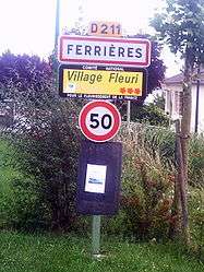
Ferrières is a commune in the Somme department in Hauts-de-France in northern France.
Geography
The commune is situated on the D211 road, some 5 miles (8 km) west of Amiens.
Population
| Year | 1962 | 1968 | 1975 | 1982 | 1990 | 1999 | 2006 |
|---|---|---|---|---|---|---|---|
| Population | 220 | 252 | 307 | 315 | 396 | 426 | 453 |
| From the year 1962 on: No double counting—residents of multiple communes (e.g. students and military personnel) are counted only once. | |||||||
Places of interest
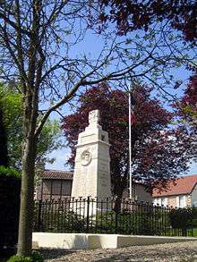
The war memorial
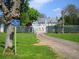
The château
See also
References
External links
| Wikimedia Commons has media related to Ferrières (Somme). |
- Ferrières on the Quid website (French)
This article is issued from Wikipedia - version of the 11/8/2016. The text is available under the Creative Commons Attribution/Share Alike but additional terms may apply for the media files.