Canaples
| Canaples | |
|---|---|
 | |
 Canaples | |
|
Location within Hauts-de-France region  Canaples | |
| Coordinates: 50°03′26″N 2°13′07″E / 50.0572°N 2.2186°E / 50.0572; 2.2186Coordinates: 50°03′26″N 2°13′07″E / 50.0572°N 2.2186°E / 50.0572; 2.2186 | |
| Country | France |
| Region | Hauts-de-France |
| Department | Somme |
| Arrondissement | Amiens |
| Canton | Domart-en-Ponthieu |
| Intercommunality | Val de Nièvre et environs |
| Government | |
| • Mayor (2001–2008) | Muriel Gruner |
| Area1 | 10.26 km2 (3.96 sq mi) |
| Population (2006)2 | 607 |
| • Density | 59/km2 (150/sq mi) |
| Time zone | CET (UTC+1) |
| • Summer (DST) | CEST (UTC+2) |
| INSEE/Postal code | 80166 / 80670 |
| Elevation |
40–153 m (131–502 ft) (avg. 54 m or 177 ft) |
|
1 French Land Register data, which excludes lakes, ponds, glaciers > 1 km² (0.386 sq mi or 247 acres) and river estuaries. 2 Population without double counting: residents of multiple communes (e.g., students and military personnel) only counted once. | |
Canaples is a commune in the Somme department in Hauts-de-France in northern France.
Geography
Canaples is situated on the D933 road, some 15 miles (24 km) north of Amiens.
Population
| Year | 1962 | 1968 | 1975 | 1982 | 1990 | 1999 | 2006 |
|---|---|---|---|---|---|---|---|
| Population | 417 | 452 | 529 | 566 | 604 | 596 | 607 |
| From the year 1962 on: No double counting—residents of multiple communes (e.g. students and military personnel) are counted only once. | |||||||
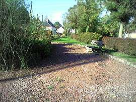
Places of interest
- The public Gardens
See also
References
External links
| Wikimedia Commons has media related to Canaples. |
This article is issued from Wikipedia - version of the 11/8/2016. The text is available under the Creative Commons Attribution/Share Alike but additional terms may apply for the media files.