Liomer
| Liomer | ||
|---|---|---|
 | ||
| ||
 Liomer | ||
|
Location within Hauts-de-France region  Liomer | ||
| Coordinates: 49°51′25″N 1°49′02″E / 49.8569°N 1.8172°E / 49.8569; 1.8172Coordinates: 49°51′25″N 1°49′02″E / 49.8569°N 1.8172°E / 49.8569; 1.8172 | ||
| Country | France | |
| Region | Hauts-de-France | |
| Department | Somme | |
| Arrondissement | Amiens | |
| Canton | Hornoy-le-Bourg | |
| Intercommunality | Sud-Ouest Amiénois | |
| Government | ||
| • Mayor (2001–2008) | Colette Michaux | |
| Area1 | 3.89 km2 (1.50 sq mi) | |
| Population (2006)2 | 352 | |
| • Density | 90/km2 (230/sq mi) | |
| Time zone | CET (UTC+1) | |
| • Summer (DST) | CEST (UTC+2) | |
| INSEE/Postal code | 80484 / 80430 | |
| Elevation |
99–180 m (325–591 ft) (avg. 109 m or 358 ft) | |
|
1 French Land Register data, which excludes lakes, ponds, glaciers > 1 km² (0.386 sq mi or 247 acres) and river estuaries. 2 Population without double counting: residents of multiple communes (e.g., students and military personnel) only counted once. | ||
.svg.png)
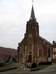
Liomer is a commune in the Somme department in Hauts-de-France in northern France.

Gallic cockerel and World War I memorial
Geography
Liomer is situated 15 miles (24 km) south of Abbeville, on the D211 road
Population
| 1936 | 1946 | 1954 | 1962 | 1968 | 1975 | 1982 | 1990 | 1999 | 2006 |
|---|---|---|---|---|---|---|---|---|---|
| 300 | 326 | 358 | 336 | 372 | 525 | 490 | 360 | 369 | 352 |
| Starting in 1962: Population without duplicates | |||||||||
See also
References
External links
| Wikimedia Commons has media related to Liomer. |
- Liomer on the Quid website (French)
- Municipal website (French)
This article is issued from Wikipedia - version of the 11/8/2016. The text is available under the Creative Commons Attribution/Share Alike but additional terms may apply for the media files.