Entrevernes
| Entrevernes | |
|---|---|
|
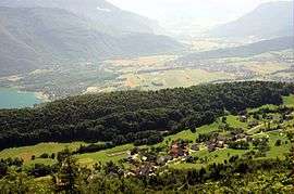
A general view of Entrevernes and the valley | |
 Entrevernes | |
|
Location within Auvergne-Rhône-Alpes region  Entrevernes | |
| Coordinates: 45°47′46″N 6°11′21″E / 45.7961°N 6.1892°ECoordinates: 45°47′46″N 6°11′21″E / 45.7961°N 6.1892°E | |
| Country | France |
| Region | Auvergne-Rhône-Alpes |
| Department | Haute-Savoie |
| Arrondissement | Arrondissement of Annecy |
| Canton | Canton of Seynod |
| Intercommunality | Communauté de communes de la Rive Gauche du Lac d'Annecy |
| Government | |
| • Mayor (2014–20) | Philippe Monmont |
| Area1 | 8.31 km2 (3.21 sq mi) |
| Population (2013)2 | 217 |
| • Density | 26/km2 (68/sq mi) |
| Time zone | CET (UTC+1) |
| • Summer (DST) | CEST (UTC+2) |
| INSEE/Postal code | 74111 / 74410 |
| Elevation | 729–1,775 m (2,392–5,823 ft) |
|
1 French Land Register data, which excludes lakes, ponds, glaciers > 1 km² (0.386 sq mi or 247 acres) and river estuaries. 2 Population without double counting: residents of multiple communes (e.g., students and military personnel) only counted once. | |
Entrevernes is a commune in the Haute-Savoie department and Auvergne-Rhône-Alpes region of eastern France.
See also
References
| Wikimedia Commons has media related to Entrevernes. |
This article is issued from Wikipedia - version of the 10/28/2016. The text is available under the Creative Commons Attribution/Share Alike but additional terms may apply for the media files.