Chavanod
| Chavanod | |
|---|---|
|
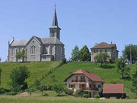
The church in Chavanod | |
 Chavanod | |
|
Location within Auvergne-Rhône-Alpes region  Chavanod | |
| Coordinates: 45°53′27″N 6°02′25″E / 45.8908°N 6.0403°ECoordinates: 45°53′27″N 6°02′25″E / 45.8908°N 6.0403°E | |
| Country | France |
| Region | Auvergne-Rhône-Alpes |
| Department | Haute-Savoie |
| Arrondissement | Annecy |
| Canton | Seynod |
| Intercommunality | Communauté de l'agglomération d'Annecy |
| Government | |
| • Mayor (2014–2020) | René Desille |
| Area1 | 13.36 km2 (5.16 sq mi) |
| Population (2013)2 | 2,379 |
| • Density | 180/km2 (460/sq mi) |
| • Urban | 139,693 |
| Time zone | CET (UTC+1) |
| • Summer (DST) | CEST (UTC+2) |
| INSEE/Postal code | 74067 / 74650 |
| Elevation | 356–624 m (1,168–2,047 ft) |
|
1 French Land Register data, which excludes lakes, ponds, glaciers > 1 km² (0.386 sq mi or 247 acres) and river estuaries. 2 Population without double counting: residents of multiple communes (e.g., students and military personnel) only counted once. | |
Chavanod is a commune in the Haute-Savoie department and Auvergne-Rhône-Alpes region of eastern France.
Geography
The River Fier forms parts of the commune's northern border.
See also
References
External links
| Wikimedia Commons has media related to Chavanod. |
This article is issued from Wikipedia - version of the 10/28/2016. The text is available under the Creative Commons Attribution/Share Alike but additional terms may apply for the media files.