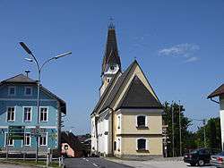
Aurach am Hongar
| Aurach am Hongar | ||
|---|---|---|
 | ||
| ||
 Aurach am Hongar Location within Austria | ||
| Coordinates: 47°57′01″N 13°40′02″E / 47.95028°N 13.66722°ECoordinates: 47°57′01″N 13°40′02″E / 47.95028°N 13.66722°E | ||
| Country | Austria | |
| State | Upper Austria | |
| District | Vöcklabruck | |
| Government | ||
| • Mayor | Josef Staufer (ÖVP) | |
| Area | ||
| • Total | 25 km2 (10 sq mi) | |
| Elevation | 488 m (1,601 ft) | |
| Population (1 January 2016)[1] | ||
| • Total | 1,672 | |
| • Density | 67/km2 (170/sq mi) | |
| Time zone | CET (UTC+1) | |
| • Summer (DST) | CEST (UTC+2) | |
| Postal code | 4861 | |
| Area code | 07662 | |
| Vehicle registration | VB | |
| Website | www.aurach.at | |

Aurach am Hongar is a municipality in the district of Vöcklabruck in the Austrian state of Upper Austria.
Population
| Historical population | ||
|---|---|---|
| Year | Pop. | ±% |
| 1991 | 1,368 | — |
| 2001 | 1,585 | +15.9% |
| 2016 | 1,672 | +5.5% |
References
| Wikimedia Commons has media related to Aurach am Hongar. |
This article is issued from Wikipedia - version of the 3/17/2016. The text is available under the Creative Commons Attribution/Share Alike but additional terms may apply for the media files.