Anould
| Anould | ||
|---|---|---|
|
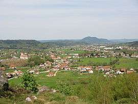
Panorama de la Roche du Sphinx | ||
| ||
 Anould | ||
|
Location within Grand Est region  Anould | ||
| Coordinates: 48°11′11″N 6°56′47″E / 48.1864°N 6.9464°ECoordinates: 48°11′11″N 6°56′47″E / 48.1864°N 6.9464°E | ||
| Country | France | |
| Region | Grand Est | |
| Department | Vosges | |
| Arrondissement | Saint-Dié-des-Vosges | |
| Canton | Fraize | |
| Intercommunality | Val de Meurthe | |
| Government | ||
| • Mayor (2008–2014) | Jacques Hestin | |
| Area1 | 24.23 km2 (9.36 sq mi) | |
| Population (2006)2 | 3,275 | |
| • Density | 140/km2 (350/sq mi) | |
| Time zone | CET (UTC+1) | |
| • Summer (DST) | CEST (UTC+2) | |
| INSEE/Postal code | 88009 / 88650 | |
| Elevation |
419–933 m (1,375–3,061 ft) (avg. 455 m or 1,493 ft) | |
|
1 French Land Register data, which excludes lakes, ponds, glaciers > 1 km² (0.386 sq mi or 247 acres) and river estuaries. 2 Population without double counting: residents of multiple communes (e.g., students and military personnel) only counted once. | ||

Anould (German: Alhausen) is a commune in the Vosges department in Grand Est in northeastern France.
See also
References
External links
| Wikimedia Commons has media related to Anould. |
This article is issued from Wikipedia - version of the 11/7/2016. The text is available under the Creative Commons Attribution/Share Alike but additional terms may apply for the media files.