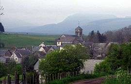
Saulzet-le-Froid
| Saulzet-le-Froid | |
|---|---|
 | |
 Saulzet-le-Froid | |
|
Location within Auvergne-Rhône-Alpes region  Saulzet-le-Froid | |
| Coordinates: 45°38′31″N 2°55′08″E / 45.642°N 2.919°ECoordinates: 45°38′31″N 2°55′08″E / 45.642°N 2.919°E | |
| Country | France |
| Region | Auvergne-Rhône-Alpes |
| Department | Puy-de-Dôme |
| Arrondissement | Clermont-Ferrand |
| Canton | Saint-Amant-Tallende |
| Intercommunality | Les Cheires |
| Area1 | 28.21 km2 (10.89 sq mi) |
| Population (2006)2 | 251 |
| • Density | 8.9/km2 (23/sq mi) |
| Time zone | CET (UTC+1) |
| • Summer (DST) | CEST (UTC+2) |
| INSEE/Postal code | 63407 / 63970 |
| Elevation |
957–1,529 m (3,140–5,016 ft) (avg. 1,015 m or 3,330 ft) |
|
1 French Land Register data, which excludes lakes, ponds, glaciers > 1 km² (0.386 sq mi or 247 acres) and river estuaries. 2 Population without double counting: residents of multiple communes (e.g., students and military personnel) only counted once. | |
Saulzet-le-Froid is a commune in the Puy-de-Dôme department in Auvergne in central France.
See also
References
| Wikimedia Commons has media related to Saulzet-le-Froid. |
This article is issued from Wikipedia - version of the 11/14/2014. The text is available under the Creative Commons Attribution/Share Alike but additional terms may apply for the media files.