Artonne
| Artonne | ||
|---|---|---|
|
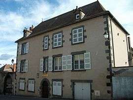
Town hall | ||
| ||
 Artonne | ||
|
Location within Auvergne-Rhône-Alpes region  Artonne | ||
| Coordinates: 46°00′15″N 3°08′41″E / 46.0042°N 3.1447°ECoordinates: 46°00′15″N 3°08′41″E / 46.0042°N 3.1447°E | ||
| Country | France | |
| Region | Auvergne-Rhône-Alpes | |
| Department | Puy-de-Dôme | |
| Arrondissement | Riom | |
| Canton | Aigueperse | |
| Intercommunality | Nord Limagne | |
| Government | ||
| • Mayor (2014–2020) | Jean-Claude Molinier[1] | |
| Area1 | 17.48 km2 (6.75 sq mi) | |
| Population (2013)2 | 845 | |
| • Density | 48/km2 (130/sq mi) | |
| Time zone | CET (UTC+1) | |
| • Summer (DST) | CEST (UTC+2) | |
| INSEE/Postal code | 63012 / 63460 | |
| Elevation |
334–532 m (1,096–1,745 ft) (avg. 348 m or 1,142 ft) | |
|
1 French Land Register data, which excludes lakes, ponds, glaciers > 1 km² (0.386 sq mi or 247 acres) and river estuaries. 2 Population without double counting: residents of multiple communes (e.g., students and military personnel) only counted once. | ||
.svg.png)
Artonne is a commune in the Puy-de-Dôme department in Auvergne-Rhône-Alpes in central France.
Population
| Historical population | ||
|---|---|---|
| Year | Pop. | ±% |
| 1962 | 707 | — |
| 1968 | 714 | +1.0% |
| 1975 | 685 | −4.1% |
| 1982 | 753 | +9.9% |
| 1990 | 779 | +3.5% |
| 1999 | 762 | −2.2% |
| 2006 | 771 | +1.2% |
| 2009 | 775 | +0.5% |
| 2013 | 845 | +9.0% |
| Source: INSEE (1968–2013) | ||
See also
References
- ↑ "List of Mayors of Puy-de-Dôme" (PDF). Prefecture of Puy-de-Dôme. 9 April 2014. Archived from the original (PDF) on 6 October 2014. Retrieved 24 June 2016.
| Wikimedia Commons has media related to Artonne. |
This article is issued from Wikipedia - version of the 10/19/2016. The text is available under the Creative Commons Attribution/Share Alike but additional terms may apply for the media files.