San Isidro, Abra
| San Isidro | |
|---|---|
| Municipality | |
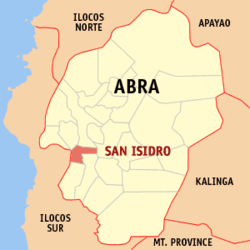 Location within Abra province | |
.svg.png) San Isidro Location within the Philippines | |
| Coordinates: 17°28′N 120°36′E / 17.47°N 120.6°ECoordinates: 17°28′N 120°36′E / 17.47°N 120.6°E | |
| Country | Philippines |
| Region | Cordillera Administrative Region (CAR) |
| Province | Abra |
| District | Lone District of Abra |
| Barangays | 9 (see Barangays) |
| Government [1] | |
| • Type | Sangguniang Bayan |
| • Mayor | Ernesto M. Pacsa Jr. |
| Area[2] | |
| • Total | 48.07 km2 (18.56 sq mi) |
| Population (2015 census)[3] | |
| • Total | 4,574 |
| • Density | 95/km2 (250/sq mi) |
| • Voter (2016)[4] | 3,063 |
| Time zone | PST (UTC+8) |
| ZIP code | 2809 |
| IDD : area code | +63 (0)74 |
| Income class | 5th class |
| PSGC | 140121000 |
San Isidro, officially the Municipality of San Isidro (Ilocano: Ili ti San Isidro, Filipino: Bayan ng San Isidro), is a municipality in the province of Abra in the Cordillera Administrative Region (CAR) of the Philippines. The population was 4,574 at the 2015 census.[3] In the 2016 election, it had 3,063 registered voters.[4]
Geography
San Isidro is located at 17°28′N 120°36′E / 17.47°N 120.6°E.
According to the Philippine Statistics Authority, the municipality has a land area of 48.07 square kilometres (18.56 sq mi)[2] constituting 1.15% of the 4,165.25-square-kilometre- (1,608.21 sq mi) total area of Abra.
Barangays
San Isidro is politically subdivided into 9 barangays.[5]
| PSGC | Barangay | Population | ±% p.a. | ||
|---|---|---|---|---|---|
| 2015[3] | 2010[6] | ||||
| 140121001 | Cabayogan | 6.6% | 304 | 301 | +0.19% |
| 140121002 | Dalimag | 15.0% | 687 | 767 | −2.08% |
| 140121003 | Langbaban | 7.6% | 347 | 342 | +0.28% |
| 140121004 | Manayday | 12.7% | 581 | 601 | −0.64% |
| 140121007 | Pantoc | 9.3% | 425 | 422 | +0.13% |
| 140121008 | Poblacion | 13.9% | 634 | 645 | −0.33% |
| 140121010 | Sabtan-olo | 7.4% | 337 | 330 | +0.40% |
| 140121012 | San Marcial | 13.5% | 619 | 769 | −4.05% |
| 140121013 | Tangbao | 14.0% | 640 | 711 | −1.98% |
| Total | 4,574 | 4,888 | −1.26% | ||
Demographics
| Population census of San Isidro | |||||||||||||||||||||||||
|---|---|---|---|---|---|---|---|---|---|---|---|---|---|---|---|---|---|---|---|---|---|---|---|---|---|
|
| ||||||||||||||||||||||||
| Source: PSA[3][6][7] | |||||||||||||||||||||||||
In the 2015 census, San Isidro had a population of 4,574.[3] The population density was 95 inhabitants per square kilometre (250/sq mi).
In the 2016 election, it had 3,063 registered voters.[4]
References
- ↑ "Municipality". Quezon City, Philippines: Department of the Interior and Local Government. Retrieved 31 May 2013.
- 1 2 "Province: Abra". PSGC Interactive. Makati City, Philippines: Philippine Statistics Authority. Retrieved 28 October 2016.
- 1 2 3 4 5 "CORDILLERA ADMINISTRATIVE REGION (CAR)". Census of Population (2015): Total Population by Province, City, Municipality and Barangay (Report). PSA. Retrieved 20 June 2016.
- 1 2 3 "2016 National and Local Elections Statistics". Commission on Elections. 2016.
- ↑ "Municipal: San Isidro, Abra". PSGC Interactive. Quezon City, Philippines: Philippine Statistics Authority. Retrieved 8 January 2016.
- 1 2 "CORDILLERA ADMINISTRATIVE REGION (CAR)". Census of Population and Housing (2010): Total Population by Province, City, Municipality and Barangay (Report). NSO. Retrieved 29 June 2016.
- ↑ "CORDILLERA ADMINISTRATIVE REGION (CAR)". Census of Population (1995, 2000 and 2007): Total Population by Province, City and Municipality (Report). NSO. Archived from the original on 24 June 2011.
External links
| Wikimedia Commons has media related to San Isidro, Abra. |
 |
Pidigan | Bangued | | |
| Nagbukel, Ilocos Sur | |
Bucay | ||
| ||||
| | ||||
| Pilar | Villaviciosa |
Bangued (capital) | |
| Municipalities | |
| Barangays | |