Saint-Pierre, Cantal
| Saint-Pierre | |
|---|---|
|
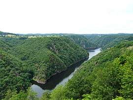
The Dordogne river seen from Saint Nazaire, the entire left part of the reservoir is located within Saint-Pierre | |
 Saint-Pierre | |
|
Location within Auvergne-Rhône-Alpes region  Saint-Pierre | |
| Coordinates: 45°23′21″N 2°23′20″E / 45.3892°N 2.3889°ECoordinates: 45°23′21″N 2°23′20″E / 45.3892°N 2.3889°E | |
| Country | France |
| Region | Auvergne-Rhône-Alpes |
| Department | Cantal |
| Arrondissement | Mauriac |
| Canton | Saignes |
| Government | |
| • Mayor (2008–2014) | Daniel Salvary |
| Area1 | 14.27 km2 (5.51 sq mi) |
| Population (2008)2 | 171 |
| • Density | 12/km2 (31/sq mi) |
| Time zone | CET (UTC+1) |
| • Summer (DST) | CEST (UTC+2) |
| INSEE/Postal code | 15206 / 15350 |
| Elevation |
352–692 m (1,155–2,270 ft) (avg. 600 m or 2,000 ft) |
|
1 French Land Register data, which excludes lakes, ponds, glaciers > 1 km² (0.386 sq mi or 247 acres) and river estuaries. 2 Population without double counting: residents of multiple communes (e.g., students and military personnel) only counted once. | |
Saint-Pierre is a commune in the Cantal department in south-central France.
Population
| Historical population | ||
|---|---|---|
| Year | Pop. | ±% |
| 1962 | 185 | — |
| 1968 | 208 | +12.4% |
| 1975 | 148 | −28.8% |
| 1982 | 148 | +0.0% |
| 1990 | 148 | +0.0% |
| 1999 | 150 | +1.4% |
| 2008 | 171 | +14.0% |
See also
References
| Wikimedia Commons has media related to Saint-Pierre (Cantal). |
This article is issued from Wikipedia - version of the 2/15/2015. The text is available under the Creative Commons Attribution/Share Alike but additional terms may apply for the media files.