Saint-Cernin, Cantal
| Saint-Cernin | |
|---|---|
|
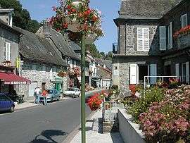
A view within the village of Saint-Cernin | |
 Saint-Cernin | |
|
Location within Auvergne-Rhône-Alpes region  Saint-Cernin | |
| Coordinates: 45°03′34″N 2°25′17″E / 45.0594°N 2.4214°ECoordinates: 45°03′34″N 2°25′17″E / 45.0594°N 2.4214°E | |
| Country | France |
| Region | Auvergne-Rhône-Alpes |
| Department | Cantal |
| Arrondissement | Aurillac |
| Canton | Saint-Cernin |
| Intercommunality | Pays de Salers |
| Government | |
| • Mayor (2008–2014) | Noël Delourme |
| Area1 | 46.75 km2 (18.05 sq mi) |
| Population (2008)2 | 1,055 |
| • Density | 23/km2 (58/sq mi) |
| Time zone | CET (UTC+1) |
| • Summer (DST) | CEST (UTC+2) |
| INSEE/Postal code | 15175 / 15310 |
| Elevation |
556–985 m (1,824–3,232 ft) (avg. 760 m or 2,490 ft) |
|
1 French Land Register data, which excludes lakes, ponds, glaciers > 1 km² (0.386 sq mi or 247 acres) and river estuaries. 2 Population without double counting: residents of multiple communes (e.g., students and military personnel) only counted once. | |
Saint-Cernin is a commune in the Cantal department in south-central France.
Population
| Historical population | ||
|---|---|---|
| Year | Pop. | ±% |
| 1962 | 1,219 | — |
| 1968 | 1,448 | +18.8% |
| 1975 | 1,314 | −9.3% |
| 1982 | 1,245 | −5.3% |
| 1990 | 1,164 | −6.5% |
| 1999 | 1,128 | −3.1% |
| 2008 | 1,055 | −6.5% |
See also
References
| Wikimedia Commons has media related to Saint-Cernin (Cantal). |
This article is issued from Wikipedia - version of the 2/15/2015. The text is available under the Creative Commons Attribution/Share Alike but additional terms may apply for the media files.