Laurie, Cantal
| Laurie | |
|---|---|
|
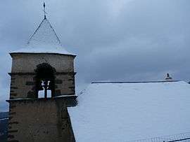
The church in the snow | |
 Laurie | |
|
Location within Auvergne-Rhône-Alpes region  Laurie | |
| Coordinates: 45°16′39″N 3°06′04″E / 45.2775°N 3.1011°ECoordinates: 45°16′39″N 3°06′04″E / 45.2775°N 3.1011°E | |
| Country | France |
| Region | Auvergne-Rhône-Alpes |
| Department | Cantal |
| Arrondissement | Saint-Flour |
| Canton | Massiac |
| Intercommunality | Pays de Massiac |
| Government | |
| • Mayor (2008–2014) | Gilbert Alezard |
| Area1 | 19.23 km2 (7.42 sq mi) |
| Population (2008)2 | 90 |
| • Density | 4.7/km2 (12/sq mi) |
| Time zone | CET (UTC+1) |
| • Summer (DST) | CEST (UTC+2) |
| INSEE/Postal code | 15098 / 15500 |
| Elevation |
649–1,200 m (2,129–3,937 ft) (avg. 840 m or 2,760 ft) |
|
1 French Land Register data, which excludes lakes, ponds, glaciers > 1 km² (0.386 sq mi or 247 acres) and river estuaries. 2 Population without double counting: residents of multiple communes (e.g., students and military personnel) only counted once. | |
Laurie is a commune in the Cantal department in south-central France.
Population
| Historical population | ||
|---|---|---|
| Year | Pop. | ±% |
| 1962 | 219 | — |
| 1968 | 200 | −8.7% |
| 1975 | 165 | −17.5% |
| 1982 | 160 | −3.0% |
| 1990 | 139 | −13.1% |
| 1999 | 117 | −15.8% |
| 2008 | 90 | −23.1% |
See also
References
| Wikimedia Commons has media related to Laurie (Cantal). |
This article is issued from Wikipedia - version of the 2/15/2015. The text is available under the Creative Commons Attribution/Share Alike but additional terms may apply for the media files.