Reugny, Allier
| Reugny | |
|---|---|
|
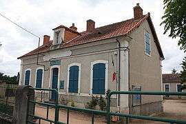
The town hall in Reugny | |
 Reugny | |
|
Location within Auvergne-Rhône-Alpes region  Reugny | |
| Coordinates: 46°27′46″N 2°36′56″E / 46.4628°N 2.6156°ECoordinates: 46°27′46″N 2°36′56″E / 46.4628°N 2.6156°E | |
| Country | France |
| Region | Auvergne-Rhône-Alpes |
| Department | Allier |
| Arrondissement | Montluçon |
| Canton | Huriel |
| Intercommunality | Val de Cher |
| Government | |
| • Mayor (2014–2020) | Bernard Garson[1] |
| Area1 | 7.66 km2 (2.96 sq mi) |
| Population (2012)2 | 268 |
| • Density | 35/km2 (91/sq mi) |
| Time zone | CET (UTC+1) |
| • Summer (DST) | CEST (UTC+2) |
| INSEE/Postal code | 03213 / 03190 |
| Elevation |
178–282 m (584–925 ft) (avg. 204 m or 669 ft) |
|
1 French Land Register data, which excludes lakes, ponds, glaciers > 1 km² (0.386 sq mi or 247 acres) and river estuaries. 2 Population without double counting: residents of multiple communes (e.g., students and military personnel) only counted once. | |
Reugny is a commune in the Allier department in Auvergne in central France.
Population
| Historical population | ||
|---|---|---|
| Year | Pop. | ±% |
| 1962 | 259 | — |
| 1968 | 275 | +6.2% |
| 1975 | 280 | +1.8% |
| 1982 | 300 | +7.1% |
| 1990 | 263 | −12.3% |
| 1999 | 272 | +3.4% |
| 2008 | 263 | −3.3% |
| 2012 | 268 | +1.9% |
| Source: INSEE (1968–2012) | ||
See also
References
- ↑ "Liste nominative des communes de l'Allier" [Nominative list of communes of Allier] (PDF). Association of Mayors and Presidents of Communities of Allier (in French). 1 April 2015. Retrieved 6 December 2015.
| Wikimedia Commons has media related to Reugny, Allier. |
This article is issued from Wikipedia - version of the 2/11/2016. The text is available under the Creative Commons Attribution/Share Alike but additional terms may apply for the media files.