Kumgyam
| Kumgyam Kungiam | |
|---|---|
| village | |
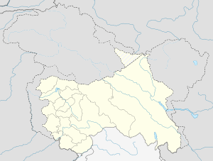 Kumgyam  Kumgyam Location in Jammu and Kashmir, India | |
| Coordinates: 33°32′04″N 78°20′17″E / 33.534353°N 78.337936°ECoordinates: 33°32′04″N 78°20′17″E / 33.534353°N 78.337936°E | |
| Country | India |
| State | Jammu and Kashmir |
| District | Leh |
| Tehsil | Leh |
| Population (2011) | |
| • Total | 374 |
| Time zone | IST (UTC+5:30) |
| Census code | 885 |
Kumgyam is a village in the Leh district of Jammu and Kashmir, India.[1] It is located in the Leh tehsil.
Demographics
According to the 2011 census of India, Kumgyam has 68 households. The effective literacy rate (i.e. the literacy rate of population excluding children aged 6 and below) is 81.85%.[2]
| Total | Male | Female | |
|---|---|---|---|
| Population | 374 | 173 | 201 |
| Children aged below 6 years | 38 | 19 | 19 |
| Scheduled caste | 0 | 0 | 0 |
| Scheduled tribe | 374 | 173 | 201 |
| Literates | 275 | 143 | 132 |
| Workers (all) | 228 | 98 | 130 |
| Main workers (total) | 226 | 97 | 129 |
| Main workers: Cultivators | 165 | 63 | 102 |
| Main workers: Agricultural labourers | 17 | 10 | 7 |
| Main workers: Household industry workers | 1 | 0 | 1 |
| Main workers: Other | 43 | 24 | 19 |
| Marginal workers (total) | 2 | 1 | 1 |
| Marginal workers: Cultivators | 0 | 0 | 0 |
| Marginal workers: Agricultural labourers | 1 | 1 | 0 |
| Marginal workers: Household industry workers | 0 | 0 | 0 |
| Marginal workers: Others | 1 | 0 | 1 |
| Non-workers | 146 | 75 | 71 |
References
- ↑ "Blockwise Village Amenity Directory" (PDF). Ladakh Autonomous Hill Development Council. Retrieved 2015-07-23.
- 1 2 "Leh district census". 2011 Census of India. Directorate of Census Operations. Retrieved 2015-07-23.
This article is issued from Wikipedia - version of the 8/26/2016. The text is available under the Creative Commons Attribution/Share Alike but additional terms may apply for the media files.