Chumathang
| Chumathang | |
|---|---|
| Village | |
|
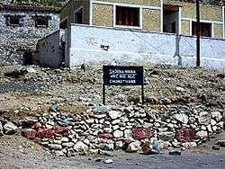
Chumathang dhaba and sign | |
 Chumathang  Chumathang Location in Jammu and Kashmir, India | |
| Coordinates: 33°22′N 78°20′E / 33.36°N 78.34°ECoordinates: 33°22′N 78°20′E / 33.36°N 78.34°E | |
| Country | India |
| State | Jammu and Kashmir |
| District | Leh |
| Tehsil | Leh |
| Elevation | 3,950 m (12,960 ft) |
| Population (2011) | |
| • Total | 641 |
| Languages | |
| • Official | Urdu, Tibetan |
| Time zone | IST (UTC+5:30) |
| PIN | 194201 |
| Census code | 900 |
Chumathang is a village in Leh District, Jammu and Kashmir in northern India on the bank of the Indus river.
It is 138 km (86 miles) southeast of Leh.,[1] and 41 km northwest of Nyoma,[2] and 29 km (18 miles) from Kiari, where there is a small medical centre run by the Indian army.[3] It lies in the banks of Indus River.
There are a few small dhabas or restaurants here making it a good spot to lunch and visit the hot springs which are about 2 km to the east. There is also a basic guesthouse and small store in the village.[4] Near the hot springs is the Hot Spring Resort which has 4 basic rooms - one with a hot bath.
Travellers coming from the south will find that Chumathang is significantly lower than the Tsomoriri lake, making it a good stop for people suffering from altitude sickness.
Gompa
Behind and above the village is a small village gompa or monastery.
-

Chumathang chorten
-
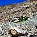
Chumathang gompa
Demographics
According to the 2011 census of India, Chumathang has 127 households. The effective literacy rate (i.e. the literacy rate of population excluding children aged 6 and below) is 68.03%.[5]
| Total | Male | Female | |
|---|---|---|---|
| Population | 641 | 237 | 404 |
| Children aged below 6 years | 56 | 29 | 27 |
| Scheduled caste | 0 | 0 | 0 |
| Scheduled tribe | 635 | 231 | 404 |
| Literates | 398 | 159 | 239 |
| Workers (all) | 222 | 106 | 116 |
| Main workers (total) | 132 | 97 | 35 |
| Main workers: Cultivators | 72 | 56 | 16 |
| Main workers: Agricultural labourers | 0 | 0 | 0 |
| Main workers: Household industry workers | 4 | 1 | 3 |
| Main workers: Other | 56 | 40 | 16 |
| Marginal workers (total) | 90 | 9 | 81 |
| Marginal workers: Cultivators | 74 | 2 | 72 |
| Marginal workers: Agricultural labourers | 0 | 0 | 0 |
| Marginal workers: Household industry workers | 0 | 0 | 0 |
| Marginal workers: Others | 16 | 7 | 9 |
| Non-workers | 419 | 131 | 288 |
References
- ↑
- ↑
- ↑ Ladakh, The Essential Guide with Kashmir and Kulu-Manali. Second Edition 2010. Partha S. Banarjee. Milestone Books, Calcutta, p. 183
- ↑
- 1 2 "Leh district census". 2011 Census of India. Directorate of Census Operations. Retrieved 2015-07-23.