Grièges
| Grièges | ||
|---|---|---|
|
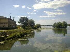
The Saône | ||
| ||
 Grièges | ||
|
Location within Auvergne-Rhône-Alpes region  Grièges | ||
| Coordinates: 46°15′20″N 4°51′04″E / 46.2556°N 4.8511°ECoordinates: 46°15′20″N 4°51′04″E / 46.2556°N 4.8511°E | ||
| Country | France | |
| Region | Auvergne-Rhône-Alpes | |
| Department | Ain | |
| Arrondissement | Bourg-en-Bresse | |
| Canton | Pont-de-Veyle | |
| Intercommunality | Pont-de-Veyle | |
| Government | ||
| • Mayor (2008–2014) | Bernard Poulet | |
| Area1 | 14.87 km2 (5.74 sq mi) | |
| Population (2008)2 | 1,800 | |
| • Density | 120/km2 (310/sq mi) | |
| Time zone | CET (UTC+1) | |
| • Summer (DST) | CEST (UTC+2) | |
| INSEE/Postal code | 01179 / 01290 | |
| Elevation |
169–212 m (554–696 ft) (avg. 268 m or 879 ft) | |
|
1 French Land Register data, which excludes lakes, ponds, glaciers > 1 km² (0.386 sq mi or 247 acres) and river estuaries. 2 Population without double counting: residents of multiple communes (e.g., students and military personnel) only counted once. | ||
.svg.png)
Grièges is a commune in the Ain department in eastern France.
Geography
The Veyle forms most of the commune's northern border, then flows into the Saône, which forms the commune's western border.
Population
| Historical population | ||
|---|---|---|
| Year | Pop. | ±% |
| 1962 | 1,025 | — |
| 1968 | 1,108 | +8.1% |
| 1975 | 1,286 | +16.1% |
| 1982 | 1,423 | +10.7% |
| 1990 | 1,606 | +12.9% |
| 1999 | 1,598 | −0.5% |
| 2008 | 1,800 | +12.6% |
See also
References
| Wikimedia Commons has media related to Grièges. |
This article is issued from Wikipedia - version of the 3/15/2016. The text is available under the Creative Commons Attribution/Share Alike but additional terms may apply for the media files.