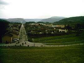
Nurieux-Volognat
| Nurieux-Volognat | ||
|---|---|---|
 | ||
| ||
 Nurieux-Volognat | ||
|
Location within Auvergne-Rhône-Alpes region  Nurieux-Volognat | ||
| Coordinates: 46°11′11″N 5°31′37″E / 46.1864°N 5.5269°ECoordinates: 46°11′11″N 5°31′37″E / 46.1864°N 5.5269°E | ||
| Country | France | |
| Region | Auvergne-Rhône-Alpes | |
| Department | Ain | |
| Arrondissement | Nantua | |
| Canton | Izernore | |
| Intercommunality | Monts Berthiand | |
| Government | ||
| • Mayor (2008–2014) | Michel Genoux | |
| Area1 | 19.31 km2 (7.46 sq mi) | |
| Population (2008)2 | 1,089 | |
| • Density | 56/km2 (150/sq mi) | |
| Time zone | CET (UTC+1) | |
| • Summer (DST) | CEST (UTC+2) | |
| INSEE/Postal code | 01267 / 01460 | |
| Elevation |
448–840 m (1,470–2,756 ft) (avg. 500 m or 1,600 ft) | |
|
1 French Land Register data, which excludes lakes, ponds, glaciers > 1 km² (0.386 sq mi or 247 acres) and river estuaries. 2 Population without double counting: residents of multiple communes (e.g., students and military personnel) only counted once. | ||
.svg.png)
Nurieux-Volognat is a commune in the Ain department in eastern France.
Population
| Historical population | ||
|---|---|---|
| Year | Pop. | ±% |
| 1962 | 466 | — |
| 1968 | 500 | +7.3% |
| 1975 | 567 | +13.4% |
| 1982 | 656 | +15.7% |
| 1990 | 856 | +30.5% |
| 1999 | 952 | +11.2% |
| 2008 | 1,089 | +14.4% |
See also
References
| Wikimedia Commons has media related to Nurieux-Volognat. |
This article is issued from Wikipedia - version of the 10/27/2016. The text is available under the Creative Commons Attribution/Share Alike but additional terms may apply for the media files.