Glanges
| Glanges | |
|---|---|
|
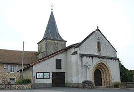
The church in Glanges | |
 Glanges | |
|
Location within Nouvelle-Aquitaine region  Glanges | |
| Coordinates: 45°40′16″N 1°27′14″E / 45.6711°N 1.4539°ECoordinates: 45°40′16″N 1°27′14″E / 45.6711°N 1.4539°E | |
| Country | France |
| Region | Nouvelle-Aquitaine |
| Department | Haute-Vienne |
| Arrondissement | Limoges |
| Canton | Saint-Germain-les-Belles |
| Intercommunality | Martoulet |
| Government | |
| • Mayor (2008–2014) | Pierre Carpe |
| Area1 | 22.85 km2 (8.82 sq mi) |
| Population (2006)2 | 498 |
| • Density | 22/km2 (56/sq mi) |
| Time zone | CET (UTC+1) |
| • Summer (DST) | CEST (UTC+2) |
| INSEE/Postal code | 87072 / 87380 |
| Elevation | 290–456 m (951–1,496 ft) |
|
1 French Land Register data, which excludes lakes, ponds, glaciers > 1 km² (0.386 sq mi or 247 acres) and river estuaries. 2 Population without double counting: residents of multiple communes (e.g., students and military personnel) only counted once. | |
Glanges (Occitan: Glanjas) is a commune in the Haute-Vienne department in the Nouvelle-Aquitaine region in west-central France.
Geography
The river Briance flows west through the northern part of the commune and forms part of its northeastern and northwestern borders.
See also
References
| Wikimedia Commons has media related to Glanges. |
This article is issued from Wikipedia - version of the 11/11/2016. The text is available under the Creative Commons Attribution/Share Alike but additional terms may apply for the media files.